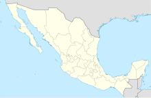
Isla de Cedros Airport
Isla de Cedros Airport Aeropuerto de Isla de Cedros | |||||||||||
|---|---|---|---|---|---|---|---|---|---|---|---|
| Summary | |||||||||||
| Airport type | Public | ||||||||||
| Operator | Exportadora de Sal S.A. | ||||||||||
| Serves | Cedros Island, Baja California, Mexico | ||||||||||
| Time zone | PST (UTC-08:00) | ||||||||||
| • Summer (DST) | PDT (UTC-07:00) | ||||||||||
| Elevation AMSL | 30 m / 98 ft | ||||||||||
| Coordinates | 28°02′15″N 115°11′22″W / 28.03750°N 115.18944°W | ||||||||||
| Map | |||||||||||
| Runways | |||||||||||
| |||||||||||
| Statistics (2022) | |||||||||||
| |||||||||||
Source: Agencia Federal de Aviación Civil | |||||||||||
Isla de Cedros Airport (Spanish: Aeropuerto de Isla de Cedros) (ICAO: MMCD, FAA LID: ICD) is a small airstrip located 9 kilometres (9.0 km) south of Cedros, the largest town on Cedros Island, Baja California, Mexico— the largest Mexican island in the Pacific Ocean. It manages commuter air traffic, connecting communities such as Cedros, El Morro, San Agustín, and La Colorada to mainland Mexico.[1]
Operated by Exportadora de Sal S.A., the largest company in the region, the airport is situated at an elevation of 30 metres (98 ft) above mean sea level. The facility features a single asphalt runway, designated as 15/33, measuring 1,420 metres (4,660 ft). Additional infrastructure includes an apron and a small terminal building.[2]
Airlines and destinations[edit]
Passenger[edit]
| Airlines | Destinations |
|---|---|
| Aéreo Servicio Guerrero | Ensenada, Guerrero Negro, Tijuana |
Destinations map[edit]
Destinations from Isla de Cedros Airport
Red = Year-round destination
Blue = Future destination
Green = Seasonal destination
Red = Year-round destination
Blue = Future destination
Green = Seasonal destination
See also[edit]
- List of the busiest airports in Mexico
- List of airports in Mexico
- List of airports by ICAO code: M
- List of busiest airports in North America
- List of the busiest airports in Latin America
- Transportation in Mexico
- Tourism in Mexico
- Exportadora de Sal S.A.
- Cedros Island
- Aereo Servicios Guerrero
References[edit]
- ^ Civil, Agencia Federal de Aviación. "Base de Datos de Aeródromos y Helipuertos". gob.mx (in Spanish). Retrieved 24 August 2023.
- ^ "MM10: ISLA CEDROS". Airport Nav Finder. Retrieved 19 September 2019.


