
Hoher Hagen (Dransfeld)
| Hoher Hagen | |
|---|---|
 | |
| Highest point | |
| Elevation | 480 m above sea level (NN) (1,570 ft) |
| Coordinates | 51°28′26″N 9°45′57″E / 51.47389°N 9.76583°E |
| Geography | |
 Hoher Hagen | |
| Geology | |
| Mountain type | volcano |
| Type of rock | basalt extrusion |

The Hoher Hagen is a volcanic hill that is still 480 m high today, in the Dransfeld Municipal Forest, in the German district of Göttingen in South Lower Saxony.
Geography[edit]
The hill, which is located south of Dransfeld, is the highest point in the Dransfeld region by a long way. It lies within the Dransfeld Municipal Forest, a hill massif in the Münden Nature Park that is about halfway between Göttingen to the northeast and Hann. Münden to the southwest.
-

-
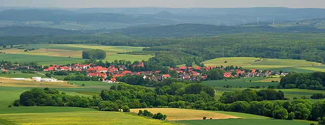 View of Jühnde from the Gauß Tower on the Hoher Hagen


Gauß Tower[edit]
On top of the Hoher Hagen stands the Gauß Tower, a 51 metre high observation tower at 478 m above NN.
Sources[edit]
- Rehkop, Friedel: Stadt Dransfeld. Ein geschichtlicher Rückblick vom 19. Jahrhundert bis zur Frühzeit. Vol. 1. Horb am Neckar: Geiger-Verlag, 1999. S.196-200,352-360,387-397. ISBN 3-89570-561-6