Haspolat
Haspolat
Μια Μηλιά (Greek) | |
|---|---|
| Coordinates: 35°12′17.77″N 33°25′17.34″E / 35.2049361°N 33.4214833°E | |
| Country (de jure) | |
| • District | Nicosia District |
| Country (de facto) | |
| • District | Lefkoşa District |
| Population (2011)[2] | |
| • Total | 4,204 |
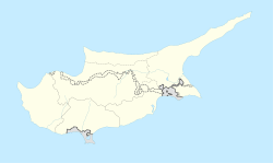
Haspolat or Mia Milia (Greek: Μια Μηλιά or Μία Μηλιά, literally 'One Apple tree') is an industrialised village and an eastern suburb of North Nicosia. Haspolat is under the de facto control of Northern Cyprus. The Cyprus International University and the new Nicosia water treatment plant are located within its boundaries.
Mia Milia is recorded as early as the early 13th century in papal documents.[3]
In 1973, Mia Milia had an all-Greek Cypriot population of 1,381. As of 2011, it had a population of 4,204, comprising Turkish Cypriots and Turkish nationals. Migrant workers have set up a shanty town near the industrial area.[4]
Notable people[edit]
- Sotiris Kaiafas, Cypriot retired footballer and European Golden Boot winner.
References[edit]
- ^ In 1983, the Turkish Republic of Northern Cyprus unilaterally declared independence from the Republic of Cyprus. The de facto state is not recognised by any UN state except Turkey.
- ^ "KKTC 2011 Nüfus ve Konut Sayımı" [TRNC 2011 Population and Housing Census] (PDF). TRNC State Planning Organization. 6 August 2013. p. 16. Archived from the original (PDF) on 6 November 2013.
- ^ Papacostas, Tasos (2012). "Byzantine Nicosia: 650-1191". In Michaelides, D. (ed.). Historic Nicosia. Nicosia: Rimal Publications. p. 87.
- ^ "MIA MILIA". Internal Displacement in Cyprus. PRIO Cyprus Centre. Archived from the original on 12 October 2018. Retrieved 20 October 2014.


