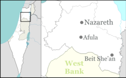
Hamadia
Hamadia
חֲמַדְיָה | |
|---|---|
 | |
| Coordinates: 32°31′13″N 35°31′11″E / 32.52028°N 35.51972°E | |
| Country | |
| District | Northern |
| Council | Valley of Springs |
| Affiliation | Kibbutz Movement |
| Founded | 1939 1942 (refoundation) |
| Population (2022)[1] | 439 |
Hamadia (Hebrew: חֲמַדְיָה) is a kibbutz in the Beit She'an Valley, just north of Beit She'an in northern Israel. It belongs to the Valley of Springs Regional Council. In 2022 it had a population of 439.[1]
Name[edit]
The kibbutz took its name from al-Hamidiyya, an abandoned Arab village north of the kibbutz named for the sultan of Ottoman Empire, Abdul Hamid II.
History[edit]
The kibbutz was founded in 1939 as part of the Tower and stockade movement. It was re-established in 1942 by the "Hermonim" pioneers, a garin of native-born Israelis who were part of a youth group.


Archaeology: Hamadiya Neolithic site[edit]
The Neolithic site at Kibbutz Hamadiya, known from archaeological literature as Hamadiya, is situated on a terrace of ancient Lake Beisan, 200 metres below sea level,[2] 10 km (6.2 mi) south of the prehistorical site of Munhata.[3] Hamadiya is suggested to date between c. 5800 and 5400 BCE.[3] Detailed reports have yet to be published.[4]
Hamadiya is a single-layer archaeological site of about 100 m2 (0.010 ha), first reported and excavated by Nehemia Zori in 1958, then again by Jacob Kaplan in 1964.[5] Ovens, pits and fireplaces were found with Yarmukian pottery and an assemblage of many axes, picks, scrapers, "saw" elements[dubious ] and sickles. Large saw elements indicate possible earlier Neolithic occupation which was suggested to date at least to the early Chalcolithic[dubious ] (MOM period 7). A flint sickle workshop was located close to the site with over 300 sickle blades found.[3]
Notable people[edit]

- Nadav Argaman, head of Shin Bet
- Gal Nevo, Olympic swimmer
References[edit]
- ^ a b "Regional Statistics". Israel Central Bureau of Statistics. Retrieved 21 March 2024.
- ^ Michael Avi-Yonah (1978). Encyclopedia of archaeological excavations in the Holy Land, p. 468. Vol. 2. Prentice-Hall. ISBN 978-0-13-275123-0. Retrieved 3 May 2011.
- ^ a b c Francis Hours (1994). Atlas des sites du Proche Orient (14000-5700 BP). Maison de l'Orient méditerranéen. ISBN 978-2-903264-53-6. Retrieved 3 May 2011.
- ^ Garfinkel, Y., The Yarmukian Culture in Israel, Paléorient, Volume 19, 19-1, pp. 115-134, 1993
- ^ British School of Archaeology in Jerusalem (2005). Levant. Retrieved 3 May 2011.
- Valley of Springs Regional Council
- Kibbutzim
- Kibbutz Movement
- Populated places established in 1939
- Populated places established in 1942
- Neolithic settlements
- Neolithic
- Prehistoric sites in Israel
- 1939 establishments in Mandatory Palestine
- 1942 establishments in Mandatory Palestine
- Populated places in Northern District (Israel)


