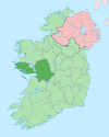
Gorumna
Native name: Garmna | |
|---|---|
 Droim Quay at south end of Garmna | |
| Geography | |
| Location | Atlantic Ocean |
| Coordinates | 53°15′N 9°41′W / 53.25°N 9.68°W |
| Administration | |
| Province | Connacht |
| County | Galway |
| Demographics | |
| Population | 1044 (2022[1]) |

Gorumna (Irish: Garmna) is an island on the west coast of Ireland, forming part of County Galway.
Geography[edit]
Gorumna Island is linked with the mainland through the Béal an Daingin Bridge. Gorumna properly consists of three individual islands in close proximity, Lettermullen, Teeranea (Irish: Tír an Fhia) and Lettermore.[2]
Contribution to Irish traditional music[edit]
During the 1860s in South Boston, Massachusetts, Bríd Ní Mháille, an immigrant from the Gorumna village of Trá Bhán, composed the Irish-language caoine Amhrán na Trá Bháine, which is about the drowning of her three brothers, whose currach was rammed and sunk while they were out at sea. Ní Mháille's lament for her brothers was first performed at a ceilidh in South Boston before being brought back to her native district in Connemara, where it continues to be passed down as both a work of oral poetry and as a very popular song among performers and fans of Irish traditional music.[3]
Geology[edit]
Gorumna Island is mostly underlain by intrusive Devonian-aged Galway Granite that formed from crustal melting as a result of the Caledonian Orogeny in the late Silurian. Its southern tip also includes Ordovician-aged bedrock of sedimentary marine rocks and basalt.[4]
Demographics[edit]
The table below reports data on Gorumna Island's population taken from Discover the Islands of Ireland (Alex Ritsema, Collins Press, 1999) and the census of Ireland.
|
|
| |||||||||||||||||||||||||||||||||||||||||||||||||||||||||||||||||||||||||||||||||||||||
| Source: Central Statistics Office. "CNA17: Population by Off Shore Island, Sex and Year". CSO.ie. Retrieved 12 October 2016. | |||||||||||||||||||||||||||||||||||||||||||||||||||||||||||||||||||||||||||||||||||||||||
References[edit]
- ^ Population of Inhabited Islands Off the Coast (Report). Central Statistics Office. 2023. Retrieved 29 June 2023.
- ^ "Gorumna Island". Mapcarta. Retrieved 17 June 2020.
- ^ Cartlanna Seosaimh Uí Éanaí: Curachaí na Trá Báine.
- ^ Holland, C. H. (Charles Hepworth) Sanders, Ian. (2009). The geology of Ireland. Dunedin Academic. ISBN 978-1-903544-49-5. OCLC 679356088.
{{cite book}}: CS1 maint: multiple names: authors list (link)
Other projects[edit]
 Media related to Gorumna Island at Wikimedia Commons


