
Gaskins, Arkansas
Gaskins is an extinct town in Carroll County, in the U.S. state of Arkansas.[1]
The community site is located on Arkansas Route 23 about 2.5 miles north of Eureka Springs. The community was on Leatherwood Creek and the Gaskins Switch Cemetery is just north of the location.[2]
The community once had a depot on the Eureka Springs Railway.[3]
References[edit]
- ^ U.S. Geological Survey Geographic Names Information System: Gaskins (historical)
- ^ Eureka Springs, Arkansas, 7.5 Minute Topographic Quadrangle, USGS, 1972
- ^ History of Benton, Washington, Carroll, Madison, Crawford, Franklin, and Sebastian Counties, Arkansas. Higginson Book Company. 1889. p. 395.
Municipalities and communities of Carroll County, Arkansas, United States | ||
|---|---|---|
| Cities | 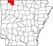 | |
| Towns | ||
| Townships | ||
| Unincorporated communities | ||
| Ghost towns | ||
| Footnotes | ‡This populated place also has portions in an adjacent county or counties | |
36°26′43″N 93°44′36″W / 36.44528°N 93.74333°W
This article about a location in Carroll County, Arkansas is a stub. You can help Wikipedia by expanding it. |