
Freedom, Utah
Freedom | |
|---|---|
 Freedom Location within the state of Utah | |
| Coordinates: 39°32′33″N 111°38′58″W / 39.54250°N 111.64944°W | |
| Country | United States |
| State | Utah |
| County | Sanpete |
| Settled | 1871 |
| Elevation | 5,787 ft (1,764 m) |
| Time zone | UTC-7 (Mountain (MST)) |
| • Summer (DST) | UTC-6 (MDT) |
| ZIP codes | 84646 |
| Area code | 435 |
| GNIS feature ID | 1441224[1] |
Freedom is an unincorporated community in Sanpete County, Utah, United States.
Description[edit]
| Census | Pop. | Note | %± |
|---|---|---|---|
| 1880 | 102 | — | |
| 1910 | 124 | — | |
| 1920 | 102 | −17.7% | |
| Source: U.S. Census Bureau[2] | |||
The settlement is a small agricultural community on the former SR-30 (1935-1966), 4 miles (6.4 km) northwest of Moroni and 6 miles (9.7 km) south of Fountain Green. It was settled in 1871 during a post-Civil War period when several patriotic names developed. The town was originally named Draper for an early settler, but was renamed Freedom in 1877.[3]
The community has always been closely associated with the town of Moroni, even being included in its census precinct through most of its history.
See also[edit]
References[edit]
- ^ a b U.S. Geological Survey Geographic Names Information System: Freedom, Utah. Retrieved May 18, 2011.
- ^ "Census of Population and Housing". U.S. Census Bureau. Archived from the original on February 8, 2006. Retrieved October 20, 2011.
- ^ The Utah Genealogical and Historical Magazine, Volumes 9-10. 1918. p. 128.
External links[edit]
![]() Media related to Freedom, Utah at Wikimedia Commons
Media related to Freedom, Utah at Wikimedia Commons
Municipalities and communities of Sanpete County, Utah, United States | ||
|---|---|---|
| Cities | 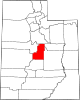 | |
| Towns | ||
| Unincorporated communities | ||
| Ghost towns | ||
This article about a location in Utah is a stub. You can help Wikipedia by expanding it. |