
File:Spiciness.pdf

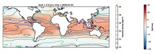
Size of this JPG preview of this PDF file: 800 × 283 pixels. Other resolutions: 320 × 113 pixels | 640 × 227 pixels | 1,952 × 691 pixels.
Original file (1,952 × 691 pixels, file size: 2.56 MB, MIME type: application/pdf)
| This is a file from the Wikimedia Commons. Information from its description page there is shown below. Commons is a freely licensed media file repository. You can help. |
Summary
| Description |
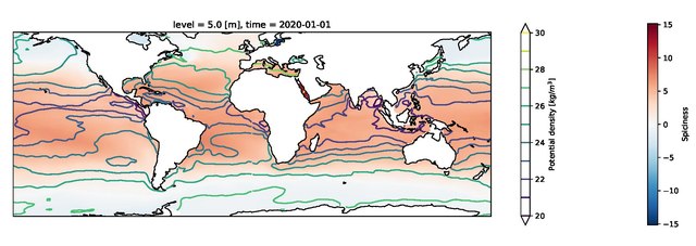
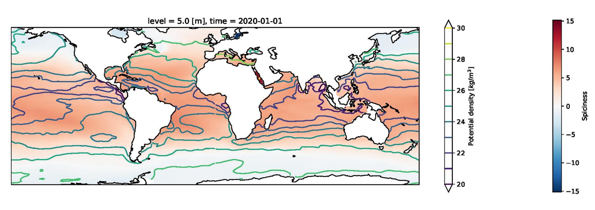
English: GODAS data provided by the NOAA/OAR/ESRL PSL, Boulder, Colorado, USA |
| Date | |
| Source | Own work |
| Author | SPouw |
Licensing
I, the copyright holder of this work, hereby publish it under the following license:
This file is licensed under the Creative Commons Attribution-Share Alike 4.0 International license.
- You are free:
- to share – to copy, distribute and transmit the work
- to remix – to adapt the work
- Under the following conditions:
- attribution – You must give appropriate credit, provide a link to the license, and indicate if changes were made. You may do so in any reasonable manner, but not in any way that suggests the licensor endorses you or your use.
- share alike – If you remix, transform, or build upon the material, you must distribute your contributions under the same or compatible license as the original.
File history
Click on a date/time to view the file as it appeared at that time.
| Date/Time | Thumbnail | Dimensions | User | Comment | |
|---|---|---|---|---|---|
| current | 20:04, 6 April 2022 | 1,952 × 691 (2.56 MB) | SPouw | Recrop | |
| 20:02, 6 April 2022 | 2,700 × 750 (2.56 MB) | SPouw | Resize | ||
| 19:16, 6 April 2022 |  | 1,650 × 750 (2.6 MB) | SPouw | Added coastlines | |
| 08:43, 24 March 2022 |  | 1,350 × 750 (2.51 MB) | SPouw | Uploaded own work with UploadWizard |
File usage
The following pages on the English Wikipedia use this file (pages on other projects are not listed):