
File:ShakeMap - 2009 West Java earthquake.pdf

Size of this JPG preview of this PDF file: 473 × 600 pixels. Other resolutions: 189 × 240 pixels | 379 × 480 pixels | 606 × 768 pixels | 1,229 × 1,558 pixels.
Original file (1,229 × 1,558 pixels, file size: 1.21 MB, MIME type: application/pdf)
| This is a file from the Wikimedia Commons. Information from its description page there is shown below. Commons is a freely licensed media file repository. You can help. |
Summary
| Description |
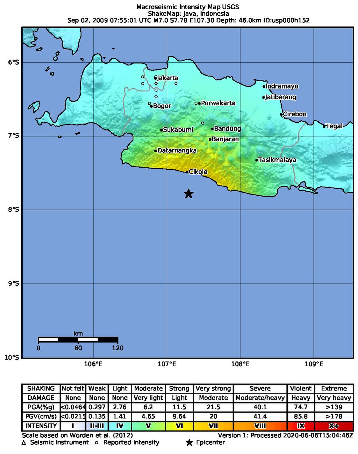
English: ShakeMap of the 7.0-magnitude 2009 West Java earthquake. |
| Date | |
| Source | https://earthquake.usgs.gov/earthquakes/eventpage/usp000h152/shakemap/intensity?source=atlas&code=usp000h152 |
| Author | United States Geological Survey |
Licensing
This image is in the public domain in the United States because it only contains materials that originally came from the United States Geological Survey, an agency of the United States Department of the Interior. For more information, see the official USGS copyright policy.
|
File history
Click on a date/time to view the file as it appeared at that time.
| Date/Time | Thumbnail | Dimensions | User | Comment | |
|---|---|---|---|---|---|
| current | 13:58, 23 October 2021 |  | 1,229 × 1,558 (1.21 MB) | Oscitare | Uploaded a work by w:United States Geological Survey from https://earthquake.usgs.gov/earthquakes/eventpage/usp000h152/shakemap/intensity?source=atlas&code=usp000h152 with UploadWizard |
File usage
The following pages on the English Wikipedia use this file (pages on other projects are not listed):
Global file usage
The following other wikis use this file:
- Usage on id.wikipedia.org
- Usage on th.wikipedia.org