
File:KBVI Airport Diagram.pdf
Size of this JPG preview of this PDF file: 390 × 599 pixels. Other resolutions: 156 × 240 pixels | 313 × 480 pixels | 806 × 1,237 pixels.
Original file (806 × 1,237 pixels, file size: 131 KB, MIME type: application/pdf)
| This is a file from the Wikimedia Commons. Information from its description page there is shown below. Commons is a freely licensed media file repository. You can help. |

|
This image is expected to always be the most recent one. Feel free to update it when needed.
|
Summary
| Description |
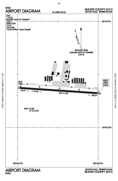
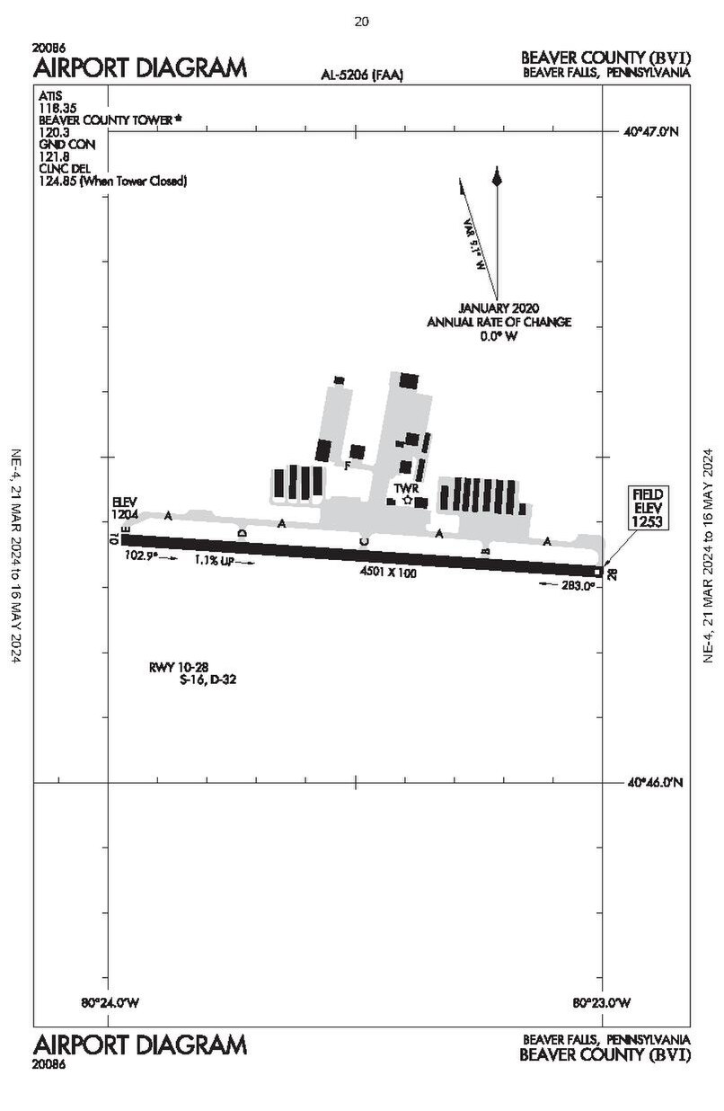
English: Airport diagram of Beaver County Aiport (BVI) |
| Date | |
| Source | Terminal Procedures Publication, page 20, effective 21 MAR 2024 to 16 MAY 2024 |
| Author | Federal Aviation Administration |
Licensing
This image or file is a work of a Federal Aviation Administration employee, taken or made as part of that person's official duties. As a work of the U.S. federal government, the image is in the public domain in the United States.
|
 |
File history
Click on a date/time to view the file as it appeared at that time.
| Date/Time | Thumbnail | Dimensions | User | Comment | |
|---|---|---|---|---|---|
| current | 00:20, 30 March 2024 |  | 806 × 1,237 (131 KB) | 痛 | Uploaded a work by {{label|Q335357}} from [https://aeronav.faa.gov/upload_313-d/terminal/2024-03-21/NE4.pdf Terminal Procedures Publication], page 20, effective 21 MAR 2024 to 16 MAY 2024 with UploadWizard |
File usage
The following pages on the English Wikipedia use this file (pages on other projects are not listed):
Global file usage
The following other wikis use this file:
- Usage on www.wikidata.org