
File:Barwon Heads Airport (YBRS) Runway Layout and Parking Map.pdf
Size of this JPG preview of this PDF file: 423 × 599 pixels. Other resolutions: 169 × 240 pixels | 339 × 480 pixels | 542 × 768 pixels | 1,231 × 1,743 pixels.
Original file (1,231 × 1,743 pixels, file size: 342 KB, MIME type: application/pdf, 2 pages)
| This is a file from the Wikimedia Commons. Information from its description page there is shown below. Commons is a freely licensed media file repository. You can help. |
Summary
| Description |
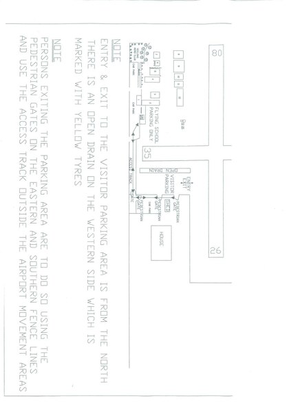
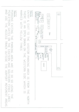
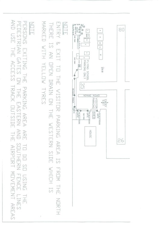
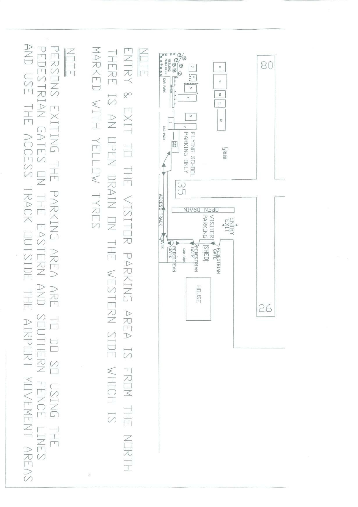
English: Map of Barwon Heads Airport (YBRS) including parking areas and usual ERSA information. |
| Date | |
| Source | Barwon Heads Airport Operators |
| Author | Barwon Heads Airport Operators |
This information is important for aircraft safety
Licensing
| This work is ineligible for copyright and therefore in the public domain because it consists entirely of information that is common property and contains no original authorship. |
File history
Click on a date/time to view the file as it appeared at that time.
| Date/Time | Thumbnail | Dimensions | User | Comment | |
|---|---|---|---|---|---|
| current | 02:12, 12 January 2010 |  | 1,231 × 1,743, 2 pages (342 KB) | Danstee | {{Information |Description={{en|1=Map of Barwon Heads Airport (YBRS) including parking areas and usual ERSA information.}} |Source=Barwon Heads Airport Operators |Author=Barwon Heads Airport Operators |Date=2010-01-12 |Permission= |other_versions= }} This |
File usage
The following pages on the English Wikipedia use this file (pages on other projects are not listed):