Districts and neighbourhoods of Brielle

From Wikipedia, the free encyclopedia

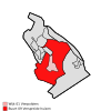
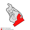
The Dutch municipality of Brielle is divided into districts and neighbourhoods for statistical purposes. The municipality is divided into the following statistical districts:

  • District 00 Brielle (CBS-neighbourhood code:050100)
  • District 01 Vierpolders (CBS-neighbourhood code:050101)
  • District 02 Zwartewaal (CBS-neighbourhood code:050102)
  • District 03 Recreatiestrook Brielse Maas (CBS-neighbourhood code:050103)

A statistical district may consist of several neighbourhoods. The table below shows the neighbourhood division with characteristic values according to the Statistics Netherlands (CBS, 2008):[1]

CBS-neighbourhood code Neighbourhood name Population Area total (ha) Area land (ha) Position
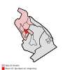
BU05010000 Brielle centrum 2820 99 77 Location in the municipality
BU05010001 Plantage en Ommeloop 780 29 27 Location in the municipality
BU05010002 Zuurland 1820 40 40 Location in the municipality
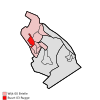
BU05010003 Rugge 2620 59 58 Location in the municipality
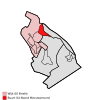
BU05010004 Meeuwenoord 520 82 46 Location in the municipality
BU05010005 Kleine Goote 1770 21 21 Location in the municipality
BU05010006 Nieuwland 1490 54 54 Location in the municipality
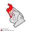
BU05010009 Verspreide huizen 230 508 454 Location in the municipality
BU05010100 Vierpolders 1280 112 112 Location in the municipality
BU05010109 Verspreide huizen 480 925 881 Location in the municipality
BU05010200 Zwartewaal 590 21 20 Location in the municipality
BU05010201 Tuindorp-Hofstede 1010 30 27 Location in the municipality
BU05010202 Zalmlaan 70 17 11 Location in the municipality
BU05010209 Verspreide huizen 250 883 802 Location in the municipality
BU05010300 Recreatiestrook Brielse Maas 30 232 120 Location in the municipality

References[edit]

  1. ^ "Centraal Bureau voor de Statistiek". 6 June 2015. Archived from Digitale publicatie wijk- en buurtkaart, 2008 the original on 20 May 2015. Retrieved 6 June 2015. {{cite web}}: Check |url= value (help)