
Curry, Walker County, Alabama
Curry, Alabama | |
|---|---|
 Curry  Curry | |
| Coordinates: 33°57′13″N 87°12′52″W / 33.95361°N 87.21444°W | |
| Country | United States |
| State | Alabama |
| County | Walker |
| Elevation | 623 ft (190 m) |
| Time zone | UTC-6 (Central (CST)) |
| • Summer (DST) | UTC-5 (CDT) |
| Area code(s) | 205, 659 |
| GNIS feature ID | 159474[1] |
Curry is an unincorporated community in north-central Walker County Alabama, United States.[1] It is the closest community to the Lewis Smith Lake dam. Curry is served by Alabama State Route 257, which is simply known as Curry Highway by locals.
Education[edit]
Curry has three primary schools. Curry Elementary, Curry Middle, and Curry High. Curry High School is a 5A school, serving grades 9–12.[2] The school colors are Blue and Gold with the mascot being the Yellow Jacket. It is a member of the Walker County Board of Education.[3]
Notable person[edit]
- Charles Martin, Alabama politician
References[edit]
- ^ a b "Curry, Alabama". Geographic Names Information System. United States Geological Survey, United States Department of the Interior.
- ^ Curry High School
- ^ "Walker County Schools". Archived from the original on January 2, 2008. Retrieved December 15, 2007.
Municipalities and communities of Walker County, Alabama, United States | ||
|---|---|---|
| Cities | 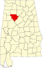 | |
| Towns | ||
| Unincorporated communities | ||
| Footnotes | ‡This populated place also has portions in an adjacent county or counties | |
This Walker County, Alabama state location article is a stub. You can help Wikipedia by expanding it. |