Corroboree Rock Conservation Reserve
| Corroboree Rock Conservation Reserve Northern Territory | |
|---|---|
IUCN category V (protected landscape/seascape)[1] | |
 Corroboree Rock | |
| Coordinates | 23°40′52″S 134°12′57″E / 23.68111°S 134.21583°E |
| Established | 1962[1] |
| Area | 7 hectares (17 acres)[1] |
| Visitation | 15,000 (in 2011)[2] |
| Managing authorities | Parks and Wildlife Commission of the Northern Territory |
| See also | Protected areas of the Northern Territory |
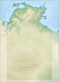
Corroboree Rock Conservation Reserve is a protected area in the Northern Territory of Australia located about 42 kilometres (26 mi) east of Alice Springs in the East MacDonnell Ranges.[2]: 1
The reserve is surrounded by the Undoolya pastoral lease which operates as a cattle station.
The reserve takes its name from a column of grey dolomite of great significance to the local Aboriginal people. The rock is part of the Bitter Springs formation that was deposited in salt lakes 800 million years ago.[3] It is a sacred site to the Eastern Arrente peoples
Flora found on the reserve include spinifex and senna on the ridges, with bloodwood, Supplejack, Red Mallee and Whitewood are found around the base of the rock.[3]
See also[edit]
Protected areas of the Northern Territory
References[edit]
- ^ a b c "Terrestrial Protected Areas by Reserve Type in the Northern Territory (2012)". Department of Environment. 2012. Retrieved 11 April 2015.
- ^ a b "Corroboree Rock Conservation Reserve - Joint Management Plan" (PDF). Northern Territory Government. 1 October 2011. Archived from the original (PDF) on 23 March 2015. Retrieved 11 April 2015.
- ^ a b "Corroboree Rock Conservation Reserve". Parks and Wildlife Commission. Retrieved 11 April 2015.

