Cerro San Antonio
Cerro San Antonio | |
|---|---|
town | |
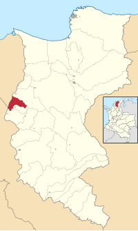
 Location of the municipality and town of Cerro San Antonio in the Department of Magdalena. | |
| Country | Colombia |
| Region | Caribbean |
| Department | Magdalena |
| Foundation | 1750 |
| Population (2005) | |
| • Total | 8,058 |
| [1] | |
| Time zone | UTC-5 |
| Website | www.cerrosanantonio-magdalena.gov.co |
Cerro San Antonio is a town and municipality of the Colombian Department of Magdalena. Founded on June 13, 1750 by Fernando de Mier y Guerra near the Magdalena River. The Libertador Simon Bolivar visited this town on May 23, 1813 during the War of Independence of Colombia from Spain.
References[edit]
External links[edit]
- (in Spanish) Cerro San Antonio official website

