
Castle, Cambridge
52°12′43″N 0°06′54″E / 52.212°N 0.115°E

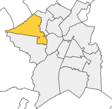
Castle is a district and electoral ward of the city of Cambridge, England.[1] It is named after the former Cambridge Castle which once stood on Castle Mound. In the UK Census 2011 the population of Castle was 9,785.[2]
The population of Castle Ward is being increased by the North West Cambridge Development, at its centre, Eddington, which began to be occupied in 2017.[3]
Castle ward borders the following other wards within the city of Cambridge (from North, proceeding clockwise): Arbury, Market and Newnham.[1] Castle is represented by three councillors on Cambridge City Council.[4] Castle Electoral Division, which has different boundaries since 2017, is represented by one councillor on Cambridgeshire County Council.[5]
References[edit]
- ^ a b "Cambridge City Ward Map". Cambridge City Council. Retrieved 12 October 2016.
- ^ "Area: Castle (Ward), Key Figures for 2011 Census". Neighbourhood Statistics. Office for National Statistics. Retrieved 12 October 2016.
- ^ "First residents move into Eddington". North West Cambridge Development. 7 July 2017. Archived from the original on 10 September 2017. Retrieved 10 January 2017.
- ^ "Find your Councillor". Cambridge City Council. Archived from the original on 22 August 2016. Retrieved 12 October 2016.
- ^ "Councillors". Cambridgeshire County Council. Retrieved 12 October 2016.
See also[edit]
This Cambridgeshire location article is a stub. You can help Wikipedia by expanding it. |