
Bussloo
Bussloo | |
|---|---|
 Church of Bussloo | |
 Bussloo Location in the Netherlands  Bussloo Bussloo (Netherlands) | |
| Coordinates: 52°11′53″N 6°07′53″E / 52.1981°N 6.1314°E | |
| Country | Netherlands |
| Province | Gelderland |
| Municipality | Voorst |
| Area | |
| • Total | 4.58 km2 (1.77 sq mi) |
| Elevation | 8 m (26 ft) |
| Population (2021)[1] | |
| • Total | 195 |
| • Density | 43/km2 (110/sq mi) |
| Time zone | UTC+1 (CET) |
| • Summer (DST) | UTC+2 (CEST) |
| Postal code | 7383[1] |
| Dialing code | 0571 |
Bussloo is a village in the municipality of Voorst in the province of Gelderland, the Netherlands. On the beach De Kuiter, on the South Western side of the lake, nudist recreation is permitted.[3]
It was first mentioned in 1390 as ten Loe, and means forest.[4] In 1818, a church is built on the estate of the Baron of Wijnbergen. The ruins of Castle Bussloo are near the church. Bussloo consists of about 55 houses.[5]
Gallery[edit]
-
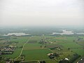 Bussloo recreation site
 -

-


.jpg)

References[edit]
- ^ a b c "Kerncijfers wijken en buurten 2021". Central Bureau of Statistics. Retrieved 24 March 2022.
Partially with Gietelo
- ^ "Postcodetool for 7383AA". Actueel Hoogtebestand Nederland (in Dutch). Het Waterschapshuis. Retrieved 24 March 2022.
- ^ "Nudist beach Bussloo". naaktstrandje.nl. Retrieved 2016-03-06.
- ^ "Bussloo - (geografische naam)". Etymologiebank (in Dutch). Retrieved 24 March 2022.
- ^ "Bussloo". Plaatsengids (in Dutch). Retrieved 24 March 2022.
Wikimedia Commons has media related to Bussloo.
This Gelderland location article is a stub. You can help Wikipedia by expanding it. |