
Bird City Township, Cheyenne County, Kansas
Bird City Township | |
|---|---|
 Location in Cheyenne County | |
| Coordinates: 39°45′3″N 101°32′1″W / 39.75083°N 101.53361°W | |
| Country | United States |
| State | Kansas |
| County | Cheyenne |
| Area | |
| • Total | 341.43 sq mi (884.29 km2) |
| • Land | 341.35 sq mi (884.11 km2) |
| • Water | 0.07 sq mi (0.19 km2) 0.02% |
| Elevation | 3,494 ft (1,065 m) |
| Population (2000) | |
| • Total | 771 |
| • Density | 2.3/sq mi (0.9/km2) |
| GNIS feature ID | 0470882 |
Bird City Township is a township in Cheyenne County, Kansas, USA. As of the 2000 census, its population was 771.
Geography[edit]
Bird City Township covers an area of 341.43 square miles (884.3 km2) and contains one incorporated settlement, Bird City. According to the USGS, it contains three cemeteries: Bird City, Community and Evergreen.
Cole Pond (historical) and Leach Pond are within this township.
Transportation[edit]
Bird City Township contains five airports or landing strips: Bird City Airport, Bursch Airport, Gillilands Farm Airport, Stout Landing Strip and Wilkens Airport.
References[edit]
External links[edit]
Municipalities and communities of Cheyenne County, Kansas, United States | ||
|---|---|---|
| Cities | 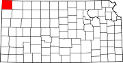 | |
| Unincorporated communities | ||
| Townships | ||
This article about a location in Cheyenne County, Kansas is a stub. You can help Wikipedia by expanding it. |