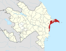
Bibiheybət
Bibiheybat | |
|---|---|
Municipality | |
| Azerbaijani: Bibiheybət | |
 | |
| Coordinates: 40°18′24″N 49°49′21″E / 40.30667°N 49.82250°E | |
| Country | |
| City | Baku |
| District | Sabail |
| Population (2008)[1] | |
| • Total | 1,451 |
| Time zone | UTC+4 (AZT) |
| • Summer (DST) | UTC+5 (AZT) |
Bibiheybət (also, Bibiheybat, Bibiheibat, Bibi-Heybat, Bibi-Heibat; formerly known as Khanlar, Euwbet, Helenendorf, and Shikhovo) is a municipality in Baku, Azerbaijan.[2] It has a population of 1,451.
In 2007, in connection with the expansion of the Bibiheybat Motorway and the reconstruction of the similarly named mosque, dozens of families were relocated to new and modern homes. In addition, a stadium, a kindergarten, and other structures were rebuilt. Around the newly reconstructed stadium, a recreation park was laid out to provide the local community with mass cultural recreation.
In 1846, the Russians drilled for an exploratory oil well in the world here, to a depth of 21 m. In the 1890s, a large oil field was discovered offshore, which led to land reclamation in 1924 in order to produce the field. Pavel Pototsky was one of the prime founders of the oil bay around Bibiheybat.[3][4][5]
Places of interest[edit]


Transportation[edit]
E60 Highway by pass Bibiheybat.
The Bibiheybet Metro Station is planned in this area by Baku Metro in the future.
See also[edit]
References[edit]
- ^ World Gazetteer: Azerbaijan [dead link] – World-Gazetteer.com
- ^ Bibiheybət at GEOnet Names Server
- ^ Azerbaijan's Oil History
- ^ Smil, Vaclav (2017). Energy and Civilization: A History. Cambridge: The MIT Press. p. 246. ISBN 9780262035774.
- ^ Blau, Eve; Rupnik, Ivan (2019). Baku: Oil and Urbanism. Park Books. pp. 60–61. ISBN 9783038600763.
External links[edit]


