Alwernia
This article needs additional citations for verification. (November 2022) |
Alwernia | |
|---|---|
Town | |
 Church of the Stigmata of St. Francis de Assisi in Alwernia | |
| Coordinates: 50°03′43″N 19°32′28″E / 50.06194°N 19.54111°E | |
| Country | |
| Voivodeship | |
| County | Chrzanów County |
| Gmina | Alwernia |
| Town rights[1] | 1 October 1993 |
| Government | |
| • Mayor | Beata Nadzieja-Szpila |
| Area | |
| • Total | 8.88 km2 (3.43 sq mi) |
| Elevation | 312 m (1,024 ft) |
| Population | |
| • Total | 3,284 |
| • Density | 370/km2 (1,000/sq mi) |
| Time zone | UTC+1 (CET) |
| • Summer (DST) | UTC+2 (CEST) |
| Postal code[6] | 32-566 |
| Area code[7] | +48 12 |
| Number plates[8] | KCH |
| Website | http://www.alwernia.pl |
Alwernia [alˈvɛrɲa] ⓘ is a town situated some 36 kilometres (22 miles) west of Kraków in the Chrzanów County, Lesser Poland Voivodeship, Poland. The town has an area of 8.88 square kilometres (3.43 square miles),[3] and as of June 2022 it has a population of 3,284.[4]
History[edit]

The name of the town is taken from that of the Franciscan hermitage of La Verna (Latin: Alvernia) in Tuscany, Italy. It was bestowed on the locality in 1616 by the castellan Krzysztof Koryciński. A monastery of the order of the Stigmata of Saint Francis of Assisi was built on high ground between 1625 and 1656. The church dates from the period between 1630 and 1676.[citation needed]
Below the monastery a settlement developed which in 1776 received the right to hold a market. In 1796 Alwernia is mentioned as being a small commercial and administrative centre.[citation needed]
After the Third Partition of Poland, the town became a part of the Austrian Empire, and since 1867 of Austria-Hungary. In the newly-reborn Poland, Alwernia administratively belonged to Kraków Voivodeship. After World War II, the town once again became a part of Kraków Voivodeship until 1998.[citation needed]
On 15 September 1993 Alwernia received its town charter.[1]
Economy[edit]
Chemical works "Alventa" is located in the town. The works was built in 1923–1924, in the interwar period. It mainly focuses on producing phosphorus and chromium compounds, as well as fertilizers.[9]
Transport[edit]

Road transport[edit]
Voivodeship road 780 directly passes through the town. The A4 motorway, which is a part of the European route E40, passes through the village of Rudno, located about 4 kilometres (2.5 miles) north of the town.
Rail transport[edit]
The Trzebinia–Wadowice railway, opened in 1899, passes through the town, however in October 2002 passenger service ceased.[10] In 2017, a tourist draisine started operating on the closed railway.[11] The railway infrastructure manager in Poland, PKP Polskie Linie Kolejowe, is planning to reconstruct the railway.[12]
Tourist attractions and monuments[edit]

Alwernia's tourist attractions and monuments include:
- Baroque Bernardine monastery and church;
- Saint Florian chapel;
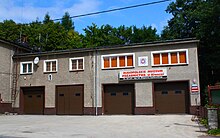
- the oldest firefighting museum in Poland – Małopolskie Muzeum Pożarnictwa.
References[edit]
- ^ a b Rozporządzenie Rady Ministrów z dnia 15 września 1993 r. w sprawie nadania niektórym miejscowościom statusu miasta, Dz. U. z 1993 r. Nr 86, poz. 400 (1993-09-15)
- ^ "Burmistrz Gminy Alwernia" [Mayor of Gmina Alwernia]. bip.malopolska.pl (in Polish). Urząd Miejski w Alwerni. Retrieved 26 November 2022.
- ^ a b "Local Data Bank". bdl.stat.gov.pl. Statistics Poland. Retrieved 26 November 2022. Category K1, group G441, subgroup P1410. Data for territorial unit 1203014.
- ^ a b "Local Data Bank". bdl.stat.gov.pl. Statistics Poland. Retrieved 23 February 2023. Category K3, group G7, subgroup P1336. Data for territorial unit 1203014.
- ^ "Local Data Bank". bdl.stat.gov.pl. Statistics Poland. Retrieved 23 February 2023. Category K3, group G7, subgroup P2425. Data for territorial unit 1203014.
- ^ "Oficjalny Spis Pocztowych Numerów Adresowych" (PDF). poczta-polska.pl (in Polish). Poczta Polska. pp. 5, 1655. Retrieved 23 February 2023.
- ^ Rozporządzenie Ministra Administracji i Cyfryzacji z dnia 30 października 2013 r. w sprawie planu numeracji krajowej dla publicznych sieci telekomunikacyjnych, w których świadczone są publicznie dostępne usługi telefoniczne, Dz. U. z 2013 r. poz. 1281 (2013-10-30)
- ^ Rozporządzenie Ministra Infrastruktury z dnia 31 sierpnia 2022 r. w sprawie rejestracji i oznaczania pojazdów, wymagań dla tablic rejestracyjnych oraz wzorów innych dokumentów związanych z rejestracją pojazdów, Dz. U. z 2022 r. poz. 1847 (2022-08-31)
- ^ "Historia" [History]. alventa.com (in Polish). Alventa SA. Retrieved 26 November 2022.
- ^ "Od dziesięciu lat nie jeżdżą tutaj pociągi". wadowiceonline.pl (in Polish). Wadowice. 7 October 2012. Retrieved 26 November 2022.
- ^ "O nas" [About us]. www.drezynyregulice.pl (in Polish). Lokalna Kolej Drezynowa w Regulicach. Retrieved 26 November 2022.
- ^ "Zamierzenia inwestycyjne na lata 2021–2030 z perspektywą do 2040 roku" (PDF). plk-sa.pl (in Polish). PKP Polskie Linie Kolejowe. p. 22. Retrieved 26 November 2022.
External links[edit]
- Official website (in Polish)
- Jewish community of Alwernia on Virtual Shtetl


