
Aloja, Latvia
Aloja | |
|---|---|
Town | |
 Flag  Coat of arms | |
 Aloja Location in Latvia | |
| Coordinates: 57°46′N 24°52′E / 57.767°N 24.867°E | |
| Country | |
| Municipality | Limbaži Municipality |
| Town rights | 1992 |
| Government | |
| • Mayor | Valdis Bārda |
| Area | |
| • Total | 2.65 km2 (1.02 sq mi) |
| • Land | 2.64 km2 (1.02 sq mi) |
| • Water | 0.01 km2 (0.004 sq mi) |
| Elevation | 217 m (712 ft) |
| Population (2023)[2] | |
| • Total | 1,077 |
| • Density | 410/km2 (1,100/sq mi) |
| Time zone | UTC+2 (EET) |
| • Summer (DST) | UTC+3 (EEST) |
| Postal code | LV-40(64-65) |
| Calling code | 640 |
| Website | www |
Aloja (German: Allendorf) is a town in Limbaži Municipality in the Vidzeme region of Latvia, situated close to the border with Estonia. It was within the former Limbaži District until 2009.
Aloja as a settlement was first mentioned in written sources in 1449. Aloja saw rapid development after Latvian agrarian reforms in 1920. In 1925, Aloja was granted a status of a village, and it also became a centre of the parish. In 1936, the new Rīga- Rūjiena railway line was constructed through Aloja. In 1992, Aloja was granted town rights. From 2009 until 2021, Aloja was the administrative center of the former Aloja Municipality.
Notable residents[edit]
- Pāvils Dreijmanis, architect
- Lauris Dzelzītis, actor
Gallery[edit]
-
 Aloja Lutheran church
 -
 Aloja Orthodox church
 -
 Aloja library
 -
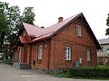
 Aloja fire station


References[edit]
- ^ "Reģionu, novadu, pilsētu un pagastu kopējā un sauszemes platība gada sākumā". Central Statistical Bureau of Latvia. Retrieved 18 January 2023.
- ^ "Iedzīvotāju skaits pēc tautības reģionos, pilsētās, novados, pagastos, apkaimēs un blīvi apdzīvotās teritorijās gada sākumā (pēc administratīvi teritoriālās reformas 2021. gadā) 2021 - 2022". Central Statistical Bureau of Latvia. Retrieved 3 October 2023.
External links[edit]
Wikimedia Commons has media related to Aloja.
This Vidzeme location article is a stub. You can help Wikipedia by expanding it. |