
Akkihebbal
Akkihebbalu | |
|---|---|
Hobli | |
| Coordinates: 12°37′19″N 76°23′39″E / 12.62197°N 76.39423°E | |
| Country | |
| State | Karnataka |
| District | Mandya |
| Taluk | K R Pete |
| Government | |
| • Body | Village Panchayat |
| Area | |
| • Total | 5.33 km2 (2.06 sq mi) |
| Elevation | 804 m (2,638 ft) |
| Population (2011) | |
| • Total | 3,946 [1] |
| Languages | |
| • Official | Kannada |
| Time zone | UTC+5:30 (IST) |
| Vehicle registration | KA-54, KA-11 |
| Nearest city | Mandya |
.jpg)
Akkihebbalu is a Hobli in the southern state of Karnataka, India.[2][3] It is located in the Krishnarajpet taluk of Mandya district in Karnataka.
It has an 800 year old Lakshmi Narasimha Swamy temple constructed by Goutama Maharshi. Rathotsava is celebrated every year in the month of February. Near to that a very old Eeshwara temple (Konkaneshwara) is located.
Akkihebbalu is connected by road(R) and rail(T) to Mysore(R&T), Hassan(R&T), Mandya(R) and Bangalore(R). It is located 55 km from Mandya, 64 km from Mysore, 61 km from Hassan and it is 168 km from Bangalore, via Somwarpet - Magadi Road.
The railway station of Akkihebbalu (station code: AKK) falls under the jurisdiction of Mysore division of South-western Railway and is the closest (16 km) railway station to Krishnarajapete.
Image gallery[edit]
-
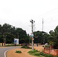 Main Road
 -
 Railway Station


References[edit]
- ^ "Census Data Handbook 2011" (PDF). Retrieved 3 August 2023.
- ^ "Census of India : List of Villages Alphabetical Order > Karnataka". Registrar General & Census Commissioner, India. Retrieved 18 December 2008.[permanent dead link], Census Village code= 2312000
- ^ "Yahoo! maps India :". Archived from the original on 18 December 2008. Retrieved 17 April 2009. Akkihebbalu, Mandya, Karnataka
External links[edit]
This article related to a location in Mandya district, Karnataka, India is a stub. You can help Wikipedia by expanding it. |