Portal:Maps
| Main page | Maps |
The Maps and Cartography Portal
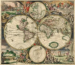
A map is a symbolic depiction emphasizing relationships between elements of some space, such as objects, regions, or themes.
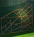
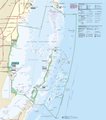
Many maps are static, fixed to paper or some other durable medium, while others are dynamic or interactive. Although most commonly used to depict geography, maps may represent any space, real or fictional, without regard to context or scale, such as in brain mapping, DNA mapping, or computer network topology mapping. The space being mapped may be two dimensional, such as the surface of the Earth, three dimensional, such as the interior of the Earth, or even more abstract spaces of any dimension, such as arise in modeling phenomena having many independent variables.
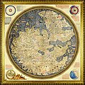
Although the earliest maps known are of the heavens, geographic maps of territory have a very long tradition and exist from ancient times. The word "map" comes from the medieval Latin: Mappa mundi, wherein mappa meant 'napkin' or 'cloth' and mundi 'the world'. Thus, "map" became a shortened term referring to a two-dimensional representation of the surface of the world. (Full article...)
Cartography (/kɑːrˈtɒɡrəfi/; from Ancient Greek: χάρτης chartēs, 'papyrus, sheet of paper, map'; and γράφειν graphein, 'write') is the study and practice of making and using maps. Combining science, aesthetics and technique, cartography builds on the premise that reality (or an imagined reality) can be modeled in ways that communicate spatial information effectively. (Full article...)
Selected article -
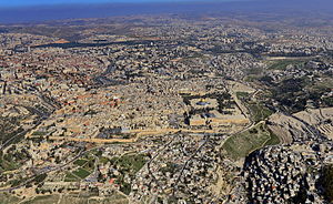
The cartography of Jerusalem is the creation, editing, processing and printing of maps of Jerusalem from ancient times until the rise of modern surveying techniques. Most extant maps known to scholars from the pre-modern era were prepared by Christian mapmakers for a Christian European audience.
Maps of Jerusalem can be categorised between original factual maps, copied maps and imaginary maps, the latter being based on religious books. The maps were produced in a variety of materials, including parchment, vellum, mosaic, wall paintings and paper. All maps marking milestones in the cartography of Jerusalem are listed here following the cartographic histories of the city, from Titus Tobler and Reinhold Röhricht's studies in the 19th century to those of Hebrew University of Jerusalem academics Rehav Rubin and Milka Levy-Rubin in recent decades. The article lists maps that progressed the cartography of Jerusalem before the rise of modern surveying techniques, showing how mapmaking and surveying improved and helped outsiders to better understand the geography of the city. Imaginary maps of the ancient city and copies of existing maps are excluded. (Full article...)General images -
Selected quote
| “ | The president of Iran should remember that Iran can also be wiped off the map. | ” |
| — Shimon Peres | ||
Related portals
Related WikiProjects
Selected biography -

Gerardus Mercator (/dʒɪˈrɑːrdəs mɜːrˈkeɪtər/; 5 March 1512 – 2 December 1594) was a Flemish geographer, cosmographer and cartographer. He is most renowned for creating the 1569 world map based on a new projection which represented sailing courses of constant bearing (rhumb lines) as straight lines—an innovation that is still employed in nautical charts.
Mercator was a notable maker of globes and scientific instruments. In addition, he had interests in theology, philosophy, history, mathematics and geomagnetism. He was also an accomplished engraver and calligrapher. Unlike other great scholars of the age, he travelled little and his knowledge of geography came from his library of over a thousand books and maps, from his visitors and from his vast correspondence (in six languages) with other scholars, statesmen, travellers, merchants and seamen. Mercator's early maps were in large formats suitable for wall mounting but in the second half of his life, he produced over 100 new regional maps in a smaller format suitable for binding into his Atlas of 1595. This was the first appearance of the word Atlas in reference to a book of maps. However, Mercator used it as a neologism for a treatise (Cosmologia) on the creation, history and description of the universe, not simply a collection of maps. He chose the word as a commemoration of the Titan Atlas, "King of Mauretania", whom he considered to be the first great geographer. (Full article...)Selected picture

Did you know
- ... that the 100 gecs tree was listed as a "place of worship" on Google Maps?
- ... that the Canadian League for Peace and Democracy organized a 10,000-person rally at Maple Leaf Gardens in Toronto to protest a 2,500-person fascist rally?
- ... that two My Little Pony: Friendship Is Magic episodes are said to discuss Marxism and Stalinism?
- ... that in 2007, Arthur Gray's £2 Kangaroo and Map stamp sold for a world record price for a single Australian stamp?
- ... that DeepStateMap.Live, an interactive map of the Russian invasion of Ukraine, received up to 120,000 visitors in 30 minutes during the Battle of Izium in the 2022 Kharkiv counteroffensive?
- ... that the actress Lottie Williams was one of the cakewalk dancers depicted on the front cover of the sheet music for Scott Joplin's "Maple Leaf Rag"?
Topics
Map - Atlas - Geography - Topography
Cartography: Cartographers - History of cartography - Ancient world maps - World maps - Compass rose - Generalization - Geographic coordinate system - Geovisualization - Relief depiction - Scale - Terra incognita - Planetary cartography
Map projection: Azimuthal equidistant - "Butterfly" - Dymaxion - Gall–Peters - General Perspective - Goode homolosine - Mercator - Mollweide - Orthographic - Peirce quincuncial - Robinson - Sinusoidal - Stereographic
Maps: Animated mapping - Cartogram - Choropleth map - Estate map - Geologic map - Linguistic map - Nautical chart - Pictorial map - Reversed map - Road atlas - Thematic map - Topographic map - Weather map - Web mapping - World map
Map examples
World
Historical
Thematic

Geographic
Political

Nautical

Categories
Things you can do
|
Here are some Geography related tasks you can do:
|
Atlases and maps of the world at Wikimedia Commons
Associated Wikimedia
The following Wikimedia Foundation sister projects provide more on this subject:
-
Commons
Free media repository -
Wikibooks
Free textbooks and manuals -
Wikidata
Free knowledge base -
Wikinews
Free-content news -
Wikiquote
Collection of quotations -
Wikisource
Free-content library -
Wikiversity
Free learning tools -
Wiktionary
Dictionary and thesaurus


