Mount Kilimanjaro
| Kilimanjaro | |
|---|---|
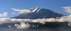
 The Kibo summit of Mount Kilimanjaro. | |
| Highest point | |
| Elevation | 5,895 m (19,341 ft)[1] |
| Prominence | 5,885 m (19,308 ft)[2] Ranked 4th[3] |
| Isolation | 5,510 km (3,420 mi) |
| Listing | |
| Coordinates | 03°04′33″S 37°21′12″E / 3.07583°S 37.35333°E |
| Geography | |
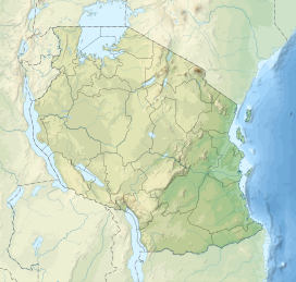
| Location | Kilimanjaro Region, north east Tanzania |
| Parent range | The Eastern Rift mountains |
| Topo map | Kilimanjaro map and guide by Wielochowski[4] |
| Geology | |
| Age of rock | 3 million years |
| Mountain type | Stratovolcano |
| Last eruption | Between 150,000 and 200,000 years ago |
| Climbing | |
| First ascent | 6 October 1889 by Hans Meyer and Ludwig Purtscheller |
| Easiest route | Hiking |
Kilimanjaro (or Kilimanjaro, which means "shining mountain" in Swahili), formerly Kaiser-Wilhelm-Spitze, is a mountain in northeastern Tanzania. Kilimanjaro is the tallest free-standing mountain rise in the world, rising 4600 meters (15,000 ft) from the base, and is the highest peak in Africa at 5,895 meters (19,340 ft).[5] It gives a dramatic view from the surrounding plains. Almost 85% of the ice cover on Kilimanjaro disappeared from October 1912 to June 2011.
Kilimanjaro is also a strato-like volcano. It has explosive eruptions. The last major eruption was about 100,000 years ago. killimanjaro is 5895 meters tall.

Climbing and acclimatization[change | change source]
There are 6 routes up Kilimanjaro: Lemosho, Machame, Marangu, Umbwe, Rongai and Northern Circuit.[6]
Since there are big differences in height, climbers can feel Altitude sickness. 7-, 8- and 9-day routes are recommended (especially for beginners), as on them it will be easier to adapt to less oxygen in the air. The more time is spent being on the slope, the easier it is to acclimatize.[7]
References[change | change source]
- ↑ "Kilimanjaro National Park". World Heritage List. UNESCO World Heritage Centre. Archived from the original on 26 May 2012. Retrieved 16 July 2015.
- ↑ "Kilimanjaro". Peakbagger.com. Archived from the original on 12 September 2012. Retrieved 16 August 2012.
- ↑ "World Peaks with 4000 meters of Prominence". Peakbagger.com. Archived from the original on 30 September 2015. Retrieved 8 November 2015.
- ↑ Kilimanjaro Map and tourist Guide (Map) (4th ed.). 1:75,000 with 1:20,000 and 1:30,000 insets. EWP Map Guides. Cartography by EWP. EWP. 2009. ISBN 0-906227-66-6. Archived from the original on 2015-07-17.
- ↑ NHK, "Kilimanjaro: White Mountain of the Equator -- Tanzania, 5,895 m"; retrieved 2012-5-24.
- ↑ "Mount Kilimanjaro Climbing". en.altezza.travel. Retrieved 2018-01-18.
- ↑ "High Altitude Acclimatization on Kilimanjaro | Climbing Tips for Beginners". Retrieved 2018-01-18.


