Portal:Indiana
The Indiana Portal
Various indigenous peoples inhabited what would become Indiana for thousands of years, some of whom the U.S. government expelled between 1800 and 1836. Indiana received its name because the state was largely possessed by native tribes even after it was granted statehood. Since then, settlement patterns in Indiana have reflected regional cultural segmentation present in the Eastern United States; the state's northernmost tier was settled primarily by people from New England and New York, Central Indiana by migrants from the Mid-Atlantic states and adjacent Ohio, and Southern Indiana by settlers from the Upland South, particularly Kentucky and Tennessee.
Indiana has a diverse economy with a gross state product of $352.62 billion in 2021. It has several metropolitan areas with populations greater than 100,000 and a number of smaller cities and towns. Indiana is home to professional sports teams, including the NFL's Indianapolis Colts and the NBA's Indiana Pacers. The state also hosts several notable competitive events, such as the Indianapolis 500, held at Indianapolis Motor Speedway. (Full article...)
Selected article -
Selected image -
 |
Did you know -
- ... that an "army" of women were congratulated by Pat Nixon for their fundraising efforts to bring public TV to Indianapolis?
- ... that a 1963 gas explosion in Indianapolis during a Holiday on Ice show was one of the worst disasters in Indiana history?
- ... that after becoming "convinced of the evils of slavery", James Townsend left Kentucky for Indiana?
- ... that after the Wolverines released their "Moose" for his fifth season, he went on to win another Big Ten championship with the Hoosiers?
- ... that the Indianapolis African-American community raised $100,000 in just ten days in 1911 to establish the Senate Avenue YMCA?
- ... that the Indianapolis Community Food Access Coalition was created to resolve food deserts in the city of Indianapolis?
Related portals
Selected geographic article -
Selected biography -
W. Axl Rose (born William Bruce Rose Jr.; born February 6, 1962) is an American singer and songwriter. He is the lead vocalist and lyricist of the hard rock band Guns N' Roses, and has been the band's sole constant member since its inception in 1985. Possessing a distinctive and powerful wide-ranging voice, Rose has been named one of the greatest singers of all time by various media outlets, including Rolling Stone, NME and Billboard.
Born and raised in Lafayette, Indiana, Rose moved in the early 1980s to Los Angeles, where he became active in the local hard rock scene and joined several bands, including Hollywood Rose and L.A. Guns. In 1985, he co-founded Guns N' Roses, with whom he had great success and recognition in the late 1980s and early 1990s. Their first album, Appetite for Destruction (1987), has sold in excess of 30 million copies worldwide and is the best-selling debut album of all time in the U.S. with 18 million units sold. Its full-length follow-ups, the twin albums Use Your Illusion I and Use Your Illusion II (1991), were also widely successful; they respectively debuted at No. 2 and No. 1 on the Billboard 200 and have sold a combined 35 million copies worldwide. (Full article...)Selected quote
General images
Topics
- Economy: AM General - ATA Airlines - Casinos - Cummins - Delta - ITT - JayC - Lilly - Limestone - Manufacturing - NiSource - Shoe Carnival - Simon Property Group - Soybeans - Studebaker - Vectren - WellPoint
- Geography: Caves - Lakes - Rivers - State forests - Watersheds
Categories
Attractions
 |
Recognized content
| This is a list of recognized content, updated weekly by JL-Bot (talk · contribs) (typically on Saturdays). There is no need to edit the list yourself. If an article is missing from the list, make sure it is tagged (e.g. {{WikiProject Indiana}}) or categorized correctly and wait for the next update. See WP:RECOG for configuration options. |
Good articles
- 1963 Indiana State Fairgrounds Coliseum gas explosion
- 2006 Brickyard 400
- 2011 South Bend mayoral election
- 2015 South Bend mayoral election
- 2019 South Bend mayoral election
- 2021 NCAA Division I men's basketball championship game
- Max Bielfeldt
- The Fault in Our Stars (film)
- Hurley Goodall
- Proposed South Shore Line station in South Bend
- WCAE
Featured pictures
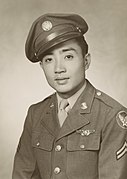
-
Kenje Ogata 1943
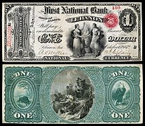
-
Kurt Vonnegut by Bernard Gotfryd (1965)
-
US-NBN-IL-Lebanon-2057-Orig-1-400-C
WikiProjects
State facts
Indiana | |
|---|---|
| Country | United States |
| Admitted to the Union | December 11, 1816 (19th) |
| Capital | Indianapolis |
| Largest city | Indianapolis |
| Largest metro and urban areas | Indianapolis-Carmel MSA |
| Government | |
| • Governor | Eric Holcomb (R) (2017) |
| • Lieutenant Governor | Suzanne Crouch (R) (2017) |
| Legislature | Indiana General Assembly |
| • Upper house | Senate |
| • Lower house | House of Representatives |
| U.S. senators | Todd Young (R) Mike Braun (R) |
| Population | |
| • Total | 6,080,485 |
| • Density | 169.5/sq mi (65.46/km2) |
| Language | |
| • Official language | English |
| Latitude | 37° 46′ N to 41° 46′ N |
| Longitude | 84° 47′ W to 88° 6′ W |
Things you can do
 |
Here are some tasks awaiting attention:
|
Associated Wikimedia
The following Wikimedia Foundation sister projects provide more on this subject:
-
Commons
Free media repository -
Wikibooks
Free textbooks and manuals -
Wikidata
Free knowledge base -
Wikinews
Free-content news -
Wikiquote
Collection of quotations -
Wikisource
Free-content library -
Wikiversity
Free learning tools -
Wikivoyage
Free travel guide -
Wiktionary
Dictionary and thesaurus
- ^ a b "Elevations and Distances in the United States". U.S Geological Survey. 29 April 2005. Retrieved 2006-11-06.


