
File:Whauphill railway station (site), Dumfries & Galloway (geograph 6162471).jpg

Size of this preview: 800 × 600 pixels. Other resolutions: 320 × 240 pixels | 640 × 480 pixels | 1,024 × 768 pixels | 1,280 × 960 pixels | 1,600 × 1,200 pixels.
Original file (1,600 × 1,200 pixels, file size: 433 KB, MIME type: image/jpeg)
| This is a file from the Wikimedia Commons. Information from its description page there is shown below. Commons is a freely licensed media file repository. You can help. |
,_Dumfries_%26_Galloway_(geograph_6162471).jpg)
Summary
| Description |
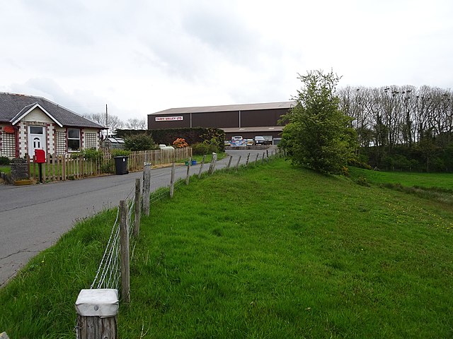
English: Whauphill railway station (site), Dumfries & Galloway Opened in 1875 by the Wigtown Railway on what later became the Portpatrick & Wigtownshire Joint Railway branch line from Newton Stewart to Whithorn, this station closed to passengers in 1950 an completely in 1964. View east up the approach road - the station stood where the business premises now are. The railway embankment can still be seen on the far right of the image, heading towards Sorbie and Whithorn. |
| Date | |
| Source | From geograph.org.uk |
| Author | Nigel Thompson |
| Permission (Reusing this file) |
Creative Commons Attribution Share-alike license 2.0 |
| Attribution (required by the license) | Nigel Thompson / Whauphill railway station (site), Dumfries & Galloway / |
| Camera location | | View this and other nearby images on: OpenStreetMap |
|---|
,_Dumfries_%26_Galloway_(geograph_6162471).jpg¶ms=054.817827_N_-004.485605_E_globe:Earth_type:camera_source:geograph-osgb36(NX40394983)_heading:90.00&language=en)
| Object location | | View this and other nearby images on: OpenStreetMap |
|---|
,_Dumfries_%26_Galloway_(geograph_6162471).jpg¶ms=054.818040_N_-004.484060_E_globe:Earth_class:object_type:object_source:geograph-osgb36(NX40494985)_heading:90.00&language=en)
Licensing

|
This image was taken from the Geograph project collection. See this photograph's page on the Geograph website for the photographer's contact details. The copyright on this image is owned by Nigel Thompson and is licensed for reuse under the Creative Commons Attribution-ShareAlike 2.0 license.
|
This file is licensed under the Creative Commons Attribution-Share Alike 2.0 Generic license.
Attribution: Nigel Thompson
- You are free:
- to share – to copy, distribute and transmit the work
- to remix – to adapt the work
- Under the following conditions:
- attribution – You must give appropriate credit, provide a link to the license, and indicate if changes were made. You may do so in any reasonable manner, but not in any way that suggests the licensor endorses you or your use.
- share alike – If you remix, transform, or build upon the material, you must distribute your contributions under the same or compatible license as the original.
File history
Click on a date/time to view the file as it appeared at that time.
| Date/Time | Thumbnail | Dimensions | User | Comment | |
|---|---|---|---|---|---|
| current | 19:39, 4 January 2020 | | 1,600 × 1,200 (433 KB) | Lamberhurst | Transferred from geograph.co.uk using [https://tools.wmflabs.org/geograph2commons/ geograph2commons] |
File usage
The following pages on the English Wikipedia use this file (pages on other projects are not listed):
Global file usage
The following other wikis use this file:
,_Dumfries_%26_Galloway_(geograph_6162471).jpg)