
File:Theviceroyaltyofperu.png
Size of this preview: 800 × 370 pixels. Other resolutions: 320 × 148 pixels | 640 × 296 pixels | 1,350 × 625 pixels.
Original file (1,350 × 625 pixels, file size: 101 KB, MIME type: image/png)
| This is a file from the Wikimedia Commons. Information from its description page there is shown below. Commons is a freely licensed media file repository. You can help. |

|
This locator map image could be re-created using vector graphics as an SVG file. This has several advantages; see Commons:Media for cleanup for more information. If an SVG form of this image is available, please upload it and afterwards replace this template with
{{vector version available|new image name}}.
It is recommended to name the SVG file “Theviceroyaltyofperu.svg”—then the template Vector version available (or Vva) does not need the new image name parameter. |
Summary
| Description |
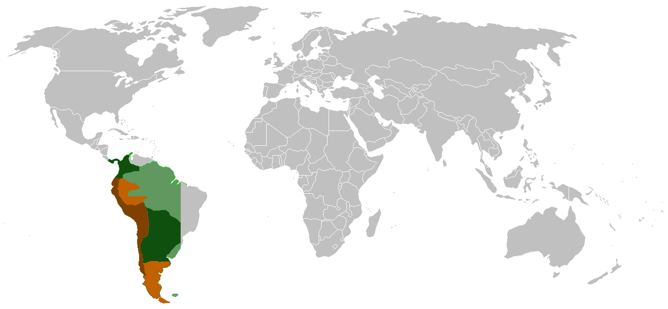
English: Coloured area (all): Theoretical extension at the moment of its creation in 1542
Dark area: Colonized area in its maximum extension ca 1650 Deutsch: Farbiger Bereich insgesamt: De-Iure-Ausdehnung bei Gründung des Vizekönigreichs Peru (1542) Dunkel getönter Bereich: effektiv beherrschtes Gebiet zum Zeitpunkt der größten Ausdehnung (um 1650) |
| Date | |
| Source | Own work |
| Author | Antoniodelemus |
Licensing
| I, the copyright holder of this work, release this work into the public domain. This applies worldwide. In some countries this may not be legally possible; if so: I grant anyone the right to use this work for any purpose, without any conditions, unless such conditions are required by law. |
File history
Click on a date/time to view the file as it appeared at that time.
| Date/Time | Thumbnail | Dimensions | User | Comment | |
|---|---|---|---|---|---|
| current | 19:25, 5 February 2024 | | 1,350 × 625 (101 KB) | Janitoalevic | . |
| 15:44, 17 June 2006 |  | 1,350 × 625 (194 KB) | Antoniodelemus~commonswiki | Description: Dark Green: Colonized area in its maximum extension ca 1650. Light green: Theoretical extension at the moment of its creation in 1542. Dark Brown: The Viceroyalty in 1816. Light Brown: De jure extension in 1816. Source: Own work. Date: |
File usage
The following pages on the English Wikipedia use this file (pages on other projects are not listed):
Global file usage
The following other wikis use this file:
- Usage on ar.wikipedia.org
- Usage on bg.wikipedia.org
- Usage on da.wikipedia.org
- Usage on de.wikipedia.org
- Usage on eo.wikipedia.org
- Usage on es.wikipedia.org
- Usage on fr.wikipedia.org
- Usage on it.wikipedia.org
- Usage on ja.wikipedia.org
- Usage on ka.wikipedia.org
- Usage on la.wikipedia.org
- Usage on nl.wikipedia.org
- Usage on pcd.wikipedia.org
- Usage on ro.wikipedia.org
- Usage on sv.wikipedia.org
- Usage on tr.wikipedia.org