
File:Remains of Rickmansworth (Church Street) Station (geograph 2096337).jpg
Size of this preview: 715 × 600 pixels. Other resolutions: 286 × 240 pixels | 572 × 480 pixels | 916 × 768 pixels | 1,221 × 1,024 pixels | 1,464 × 1,228 pixels.
Original file (1,464 × 1,228 pixels, file size: 540 KB, MIME type: image/jpeg)
| This is a file from the Wikimedia Commons. Information from its description page there is shown below. Commons is a freely licensed media file repository. You can help. |
_Station_(geograph_2096337).jpg)
Summary
| Description |
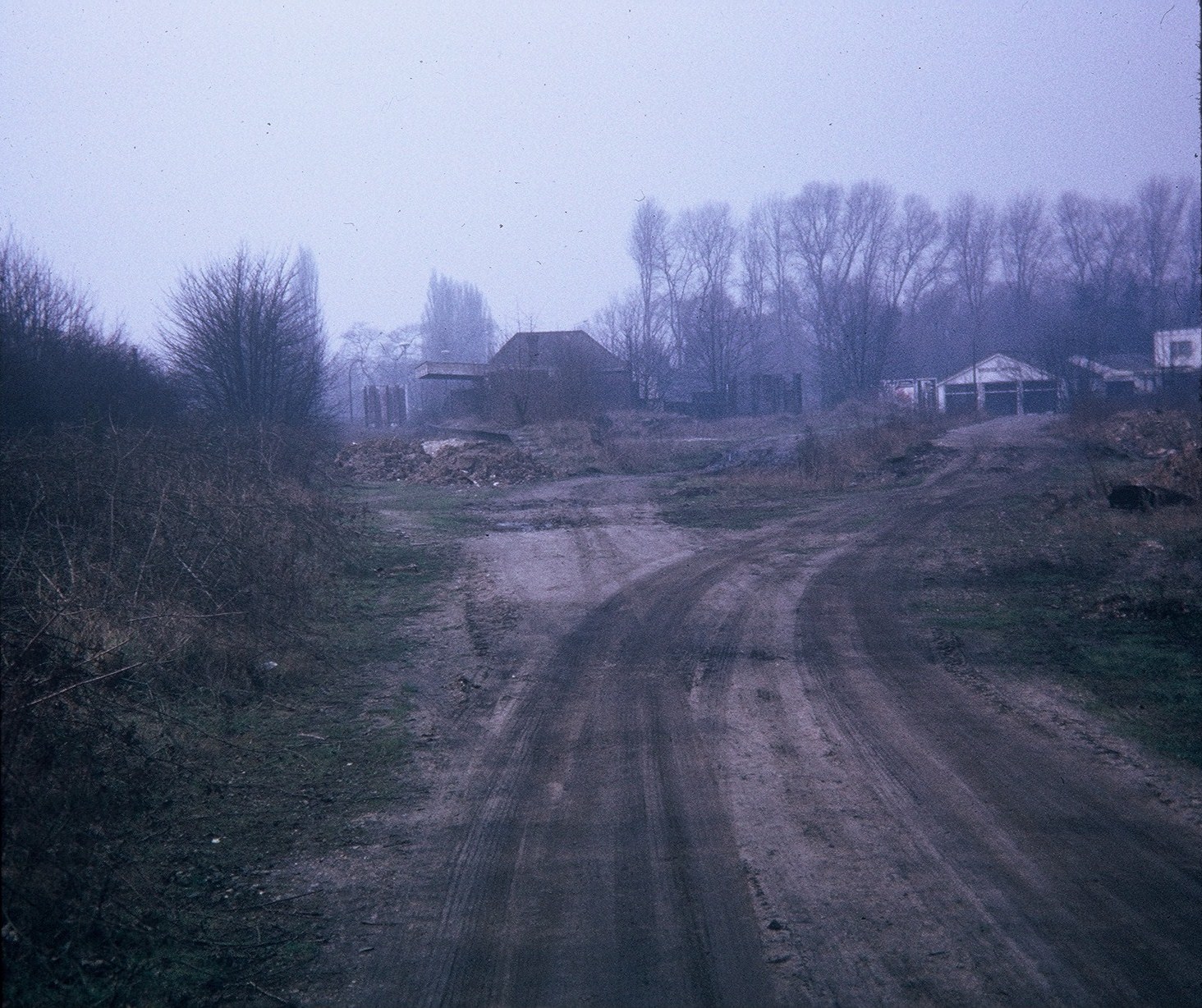
English: Remains of Rickmansworth (Church Street) Station This station was the terminus of the railway line to Watford which closed to passengers on the 3rd March, 1952. The track was lifted in late 1967 and subsequently became the Ebury Way path. Housing now occupies the station site. Its postcode is WD3 1JF. Bridge Motors garage can be seen in the background on the right. |
| Date | |
| Source | From geograph.org.uk |
| Author | David Hillas |
| Permission (Reusing this file) |
Creative Commons Attribution Share-alike license 2.0 |
| Attribution (required by the license) | David Hillas / Remains of Rickmansworth (Church Street) Station / |
| Camera location | | View this and other nearby images on: OpenStreetMap |
|---|
_Station_(geograph_2096337).jpg¶ms=051.636404_N_-000.466258_E_globe:Earth_type:camera_heading:247.00_source:geograph&language=en)
| Object location | | View this and other nearby images on: OpenStreetMap |
|---|
_Station_(geograph_2096337).jpg¶ms=051.636370_N_-000.467100_E_globe:Earth_class:object_type:object_source:geograph-osgb36(TQ06189417)_region:GB-GBN_heading:247.00&language=en)
Licensing

|
This image was taken from the Geograph project collection. See this photograph's page on the Geograph website for the photographer's contact details. The copyright on this image is owned by David Hillas and is licensed for reuse under the Creative Commons Attribution-ShareAlike 2.0 license.
|
This file is licensed under the Creative Commons Attribution-Share Alike 2.0 Generic license.
Attribution: David Hillas
- You are free:
- to share – to copy, distribute and transmit the work
- to remix – to adapt the work
- Under the following conditions:
- attribution – You must give appropriate credit, provide a link to the license, and indicate if changes were made. You may do so in any reasonable manner, but not in any way that suggests the licensor endorses you or your use.
- share alike – If you remix, transform, or build upon the material, you must distribute your contributions under the same or compatible license as the original.
File history
Click on a date/time to view the file as it appeared at that time.
| Date/Time | Thumbnail | Dimensions | User | Comment | |
|---|---|---|---|---|---|
| current | 01:05, 15 January 2015 | | 1,464 × 1,228 (540 KB) | File Upload Bot (Magnus Manske) | Transferred from Geograph by User:cnbrb |
| 01:05, 15 January 2015 |  | 1,464 × 1,228 (540 KB) | File Upload Bot (Magnus Manske) | Transferred from Geograph by User:cnbrb |
File usage
The following pages on the English Wikipedia use this file (pages on other projects are not listed):
Global file usage
The following other wikis use this file:
- Usage on www.wikidata.org
_Station_(geograph_2096337).jpg)