
File:RAF Little Rissington - geograph.org.uk - 781517.jpg
No higher resolution available.
RAF_Little_Rissington_-_geograph.org.uk_-_781517.jpg (640 × 379 pixels, file size: 144 KB, MIME type: image/jpeg)
| This is a file from the Wikimedia Commons. Information from its description page there is shown below. Commons is a freely licensed media file repository. You can help. |
Summary
| Description |
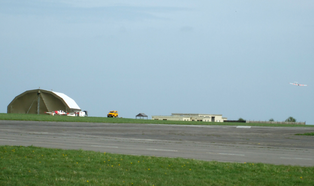
English: RAF Little Rissington There was some gliding taking place when I took this photo.
At 730 feet above sea level, RAF Little Rissington is the highest paved aerodrome in the mainland of the United Kingdom. RAF Little Rissington is presently used for flying training, a relief landing ground (RLG) for RAF Benson and RAF Lyneham, and ground training by RAF Brize Norton and various Army Units. |
| Date | |
| Source | From geograph.org.uk |
| Author | terry joyce |
| Attribution (required by the license) | terry joyce / RAF Little Rissington / |
| Camera location | | View this and other nearby images on: OpenStreetMap |
|---|
_heading:67.00&language=en)
| Object location | | View this and other nearby images on: OpenStreetMap |
|---|
_heading:67.00&language=en)
Licensing

|
This image was taken from the Geograph project collection. See this photograph's page on the Geograph website for the photographer's contact details. The copyright on this image is owned by terry joyce and is licensed for reuse under the Creative Commons Attribution-ShareAlike 2.0 license.
|
This file is licensed under the Creative Commons Attribution-Share Alike 2.0 Generic license.
Attribution: terry joyce
- You are free:
- to share – to copy, distribute and transmit the work
- to remix – to adapt the work
- Under the following conditions:
- attribution – You must give appropriate credit, provide a link to the license, and indicate if changes were made. You may do so in any reasonable manner, but not in any way that suggests the licensor endorses you or your use.
- share alike – If you remix, transform, or build upon the material, you must distribute your contributions under the same or compatible license as the original.
File history
Click on a date/time to view the file as it appeared at that time.
| Date/Time | Thumbnail | Dimensions | User | Comment | |
|---|---|---|---|---|---|
| current | 02:11, 20 February 2011 | | 640 × 379 (144 KB) | GeographBot | == {{int:filedesc}} == {{Information |description={{en|1=RAF Little Rissington There was some gliding taking place when I took this photo. At 730 feet above sea level, RAF Little Rissington is the highest paved aerodrome in the mainland of the United K |
File usage
The following pages on the English Wikipedia use this file (pages on other projects are not listed):
Global file usage
The following other wikis use this file:
- Usage on vi.wikipedia.org