
File:New Romney RH&DR station, 1938 (geograph 5126611).jpg
Size of this preview: 800 × 436 pixels. Other resolutions: 320 × 174 pixels | 640 × 348 pixels | 1,024 × 557 pixels | 1,280 × 697 pixels | 2,353 × 1,281 pixels.
Original file (2,353 × 1,281 pixels, file size: 1.7 MB, MIME type: image/jpeg)
| This is a file from the Wikimedia Commons. Information from its description page there is shown below. Commons is a freely licensed media file repository. You can help. |
.jpg)
Summary
| Description |
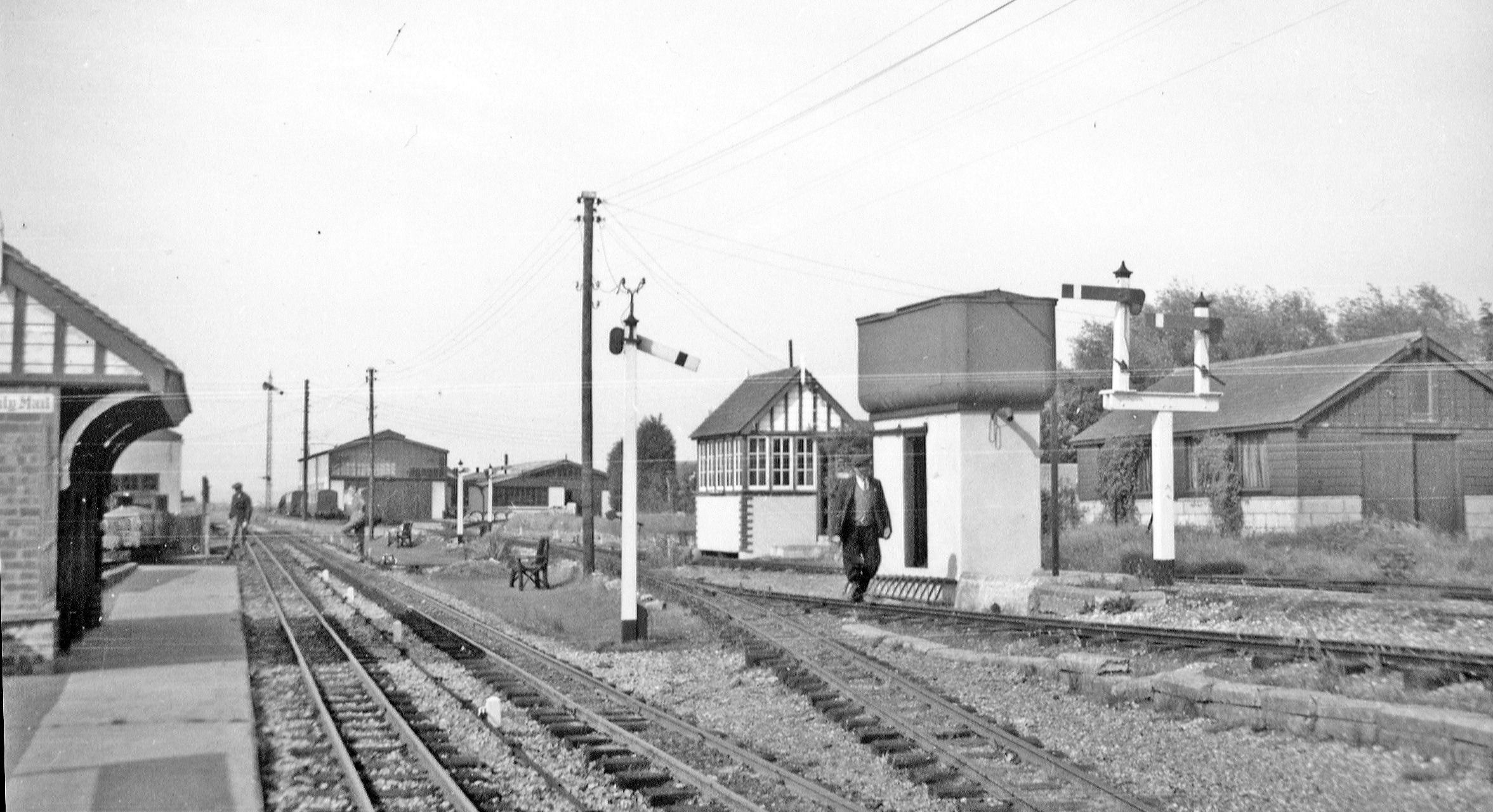
English: New Romney RH&DR station, 1938 View northward, towards Hythe, on the Romney, Hythe & Dymchurch (15in. gauge) Railway. In the distance is the RH&DR engine-shed. The terminus of the standard-gauge ex-SE&CR branch from Lydd and Appledore was behind the camera. |
| Date | |
| Source | From geograph.org.uk |
| Author | Walter Dendy, deceased |
| Permission (Reusing this file) |
Creative Commons Attribution Share-alike license 2.0 |
| Attribution (required by the license) | Walter Dendy, deceased / New Romney RH&DR station, 1938 / |
| Camera location | | View this and other nearby images on: OpenStreetMap |
|---|
.jpg¶ms=050.985936_N_0000.954183_E_globe:Earth_type:camera_source:geograph-osgb36(TR07442488)_heading:45.00&language=en)
| Object location | | View this and other nearby images on: OpenStreetMap |
|---|
.jpg¶ms=050.986020_N_0000.954330_E_globe:Earth_class:object_type:object_source:geograph-osgb36(TR07452489)_heading:45.00&language=en)
Licensing

|
This image was taken from the Geograph project collection. See this photograph's page on the Geograph website for the photographer's contact details. The copyright on this image is owned by Walter Dendy, deceased and is licensed for reuse under the Creative Commons Attribution-ShareAlike 2.0 license.
|
This file is licensed under the Creative Commons Attribution-Share Alike 2.0 Generic license.
Attribution: Walter Dendy, deceased
- You are free:
- to share – to copy, distribute and transmit the work
- to remix – to adapt the work
- Under the following conditions:
- attribution – You must give appropriate credit, provide a link to the license, and indicate if changes were made. You may do so in any reasonable manner, but not in any way that suggests the licensor endorses you or your use.
- share alike – If you remix, transform, or build upon the material, you must distribute your contributions under the same or compatible license as the original.
File history
Click on a date/time to view the file as it appeared at that time.
| Date/Time | Thumbnail | Dimensions | User | Comment | |
|---|---|---|---|---|---|
| current | 15:08, 14 April 2019 | | 2,353 × 1,281 (1.7 MB) | Lamberhurst | Transferred from geograph.co.uk using [https://tools.wmflabs.org/geograph2commons/ geograph2commons] |
File usage
The following pages on the English Wikipedia use this file (pages on other projects are not listed):
.jpg)