
File:Minneapolis-MN-SVS1999-1002.jpg
Size of this preview: 800 × 600 pixels. Other resolutions: 320 × 240 pixels | 640 × 480 pixels | 1,024 × 768 pixels | 1,280 × 960 pixels | 2,560 × 1,920 pixels.
Original file (2,560 × 1,920 pixels, file size: 2.92 MB, MIME type: image/jpeg)
| This is a file from the Wikimedia Commons. Information from its description page there is shown below. Commons is a freely licensed media file repository. You can help. |
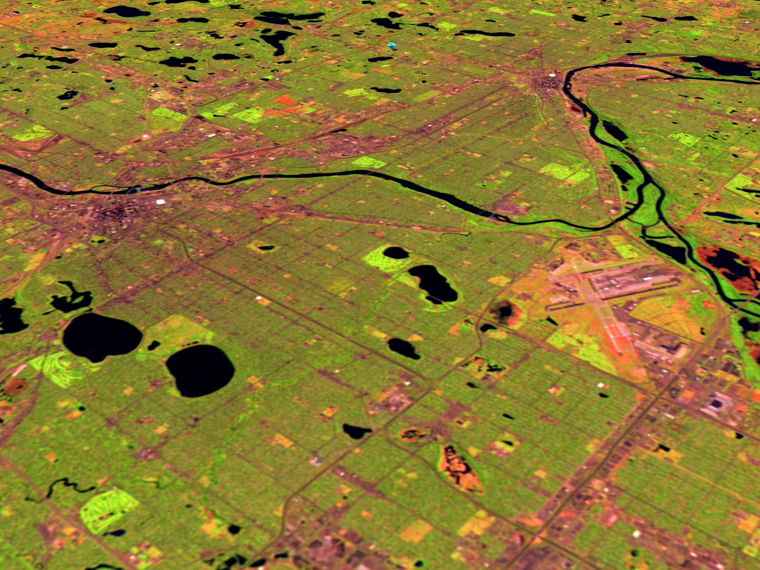
| Description | video SVS1999-1002: Minneapolis, Minnesota... "as seen by the Landsat Thematic Mapper (TM) instrument. The shortwave infrared (TM band 5), infrared (TM band 4), and visible green (TM band 2) channels are displayed in the images as red, green, and blue respectively. In this combination, barren and/or recently cultivated land appears red to pink, vegetation appears green, water is dark blue, and artificial structures of concrete and asphalt appear dark grey or black." | |||||
| Date | ||||||
| Source | http://svs.gsfc.nasa.gov/vis/a000000/a000800/a000858/index.html | |||||
| Author | NASA/Goddard Space Flight Center, Scientific Visualization Studio | |||||
| Permission (Reusing this file) |
|

File history
Click on a date/time to view the file as it appeared at that time.
| Date/Time | Thumbnail | Dimensions | User | Comment | |
|---|---|---|---|---|---|
| current | 06:47, 9 March 2007 | | 2,560 × 1,920 (2.92 MB) | SusanLesch | {{Information |Description=video SVS1999-1002: Minneapolis, Minnesota... "as seen by the Landsat Thematic Mapper (TM) instrument. The shortwave infrared (TM band 5), infrared (TM band 4), and visible green (TM band 2) channels are displayed in the ima |
File usage
The following pages on the English Wikipedia use this file (pages on other projects are not listed):