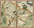
File:Mercator Rheinpfalz189v.jpg

Size of this preview: 717 × 599 pixels. Other resolutions: 287 × 240 pixels | 574 × 480 pixels | 919 × 768 pixels | 1,225 × 1,024 pixels | 2,171 × 1,815 pixels.
Original file (2,171 × 1,815 pixels, file size: 1.77 MB, MIME type: image/jpeg)
File history
Click on a date/time to view the file as it appeared at that time.
| Date/Time | Thumbnail | Dimensions | User | Comment | |
|---|---|---|---|---|---|
| current | 23:56, 16 September 2006 |  | 2,171 × 1,815 (1.77 MB) | Finanzer | {{Information |Description=Aus dem Mercatoratlas, Rheinpfalz |Source= |Date= |Author=1578 |Permission=Gerhard Mercator |other_versions= }} |
File usage
The following pages on the English Wikipedia use this file (pages on other projects are not listed):
Global file usage
The following other wikis use this file:
- Usage on cs.wikipedia.org
- Usage on de.wikipedia.org
- Usage on de.wikisource.org
- Usage on hu.wikipedia.org
- Usage on it.wikipedia.org
- Usage on ro.wikipedia.org
