
File:Map of Wards of New Orleans with Number Labels.png
Size of this preview: 784 × 599 pixels. Other resolutions: 314 × 240 pixels | 628 × 480 pixels | 960 × 734 pixels.
Original file (960 × 734 pixels, file size: 138 KB, MIME type: image/png)
| This is a file from the Wikimedia Commons. Information from its description page there is shown below. Commons is a freely licensed media file repository. You can help. |
Summary
| Description |
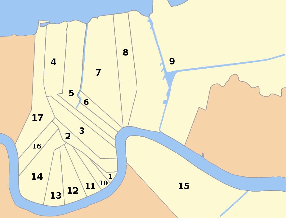
English: Map of the 17 wards of New Orleans with number labels. Note that the map doesn't show all of the 9th and 15th Wards. |
| Date | |
| Source | Own work |
| Author | Williamcasey |
Licensing
I, the copyright holder of this work, hereby publish it under the following license:
This file is licensed under the Creative Commons Attribution-Share Alike 4.0 International license.
- You are free:
- to share – to copy, distribute and transmit the work
- to remix – to adapt the work
- Under the following conditions:
- attribution – You must give appropriate credit, provide a link to the license, and indicate if changes were made. You may do so in any reasonable manner, but not in any way that suggests the licensor endorses you or your use.
- share alike – If you remix, transform, or build upon the material, you must distribute your contributions under the same or compatible license as the original.
File history
Click on a date/time to view the file as it appeared at that time.
| Date/Time | Thumbnail | Dimensions | User | Comment | |
|---|---|---|---|---|---|
| current | 22:15, 31 August 2016 | | 960 × 734 (138 KB) | WClarke | Added the Intercostal Waterway and Industrial Canal that originally were erroneously excluded from this map. |
| 04:42, 31 August 2016 |  | 960 × 734 (126 KB) | WClarke | User created page with UploadWizard |
File usage
The following pages on the English Wikipedia use this file (pages on other projects are not listed):