
File:Karte Wallis 1545.jpg

Size of this preview: 778 × 600 pixels. Other resolutions: 311 × 240 pixels | 623 × 480 pixels | 996 × 768 pixels | 1,104 × 851 pixels.
Original file (1,104 × 851 pixels, file size: 505 KB, MIME type: image/jpeg)
| This is a file from the Wikimedia Commons. Information from its description page there is shown below. Commons is a freely licensed media file repository. You can help. |
Summary
| Description |
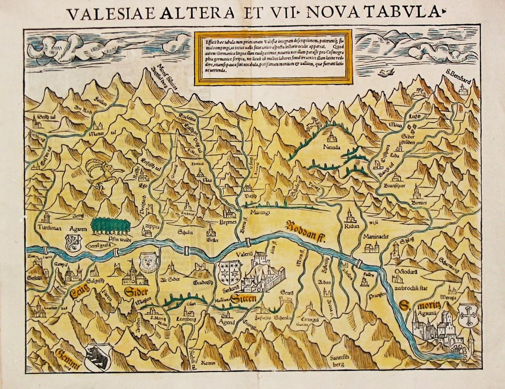
English: Oldest known map of the Valais, drawn by Johannes Schalbetter, printed by Sebastian Münster in Basel, 1545–1552. 26.0 x 34.0 cm.
Blumer, Bibliographie der Gesamtkarten der Schweiz, entry 23. The map faces south. It only shows the central portion of the Valais, from Leuk to Saint-Maurice, cutting off the Upper Valais communes of Goms, Brig, Visp and Raron. The Matterhorn is prominently labelled Mons Silvius / Augstal berg. The Great St Bernard Pass is shown top right, the Gemmi Pass bottom left.
|
| Date | |
| Source | print by Sebastian Münster. Immediate source: swaen.com |
| Author | Johannes Schalbetter, Sebastian Münster |
Licensing
|
This work is in the public domain in its country of origin and other countries and areas where the copyright term is the author's life plus 100 years or fewer. | |
| This file has been identified as being free of known restrictions under copyright law, including all related and neighboring rights. | |
File history
Click on a date/time to view the file as it appeared at that time.
| Date/Time | Thumbnail | Dimensions | User | Comment | |
|---|---|---|---|---|---|
| current | 07:27, 7 July 2017 | | 1,104 × 851 (505 KB) | Dbachmann | {{Information |Description ={{en|1=Oldest known map of the Valais.}} |Source =print by Sebastian Münster. Immediate source: [http://www.swaen.com/antique-map-of.php?id=8122 swaen.com] |Author =Johannes Schalbetter, Sebastian Münste... |
File usage
The following pages on the English Wikipedia use this file (pages on other projects are not listed):