
File:Joseph Davis State Park.jpg

Size of this preview: 800 × 524 pixels. Other resolutions: 320 × 209 pixels | 640 × 419 pixels | 1,024 × 670 pixels | 1,280 × 838 pixels | 2,560 × 1,676 pixels | 4,000 × 2,618 pixels.
Original file (4,000 × 2,618 pixels, file size: 5.65 MB, MIME type: image/jpeg)
| This is a file from the Wikimedia Commons. Information from its description page there is shown below. Commons is a freely licensed media file repository. You can help. |
Summary
| Description |
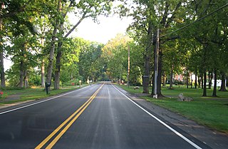
Joseph Davis State Park is located in the Town of Lewiston in Niagara County, New York. The park is near the Niagara River. This park has a free 27-hole disc golf course with restrooms and campground nearby. It has a finishing point of The Amazing Race: Family Edition when the Linz family had won. <a href="http://en.wikipedia.org/wiki/Joseph_Davis_State_Park" rel="nofollow">en.wikipedia.org/wiki/Joseph_Davis_State_Park</a> en.wikipedia.org/wiki/Wikipedia:Text_of_Creative_Commons_... |
| Date | |
| Source | Joseph Davis State Park, Near Youngstown, New York |
| Author | Ken Lund from Reno, Nevada, USA |
| Camera location | | View this and other nearby images on: OpenStreetMap |
|---|
Licensing
This file is licensed under the Creative Commons Attribution-Share Alike 2.0 Generic license.
- You are free:
- to share – to copy, distribute and transmit the work
- to remix – to adapt the work
- Under the following conditions:
- attribution – You must give appropriate credit, provide a link to the license, and indicate if changes were made. You may do so in any reasonable manner, but not in any way that suggests the licensor endorses you or your use.
- share alike – If you remix, transform, or build upon the material, you must distribute your contributions under the same or compatible license as the original.
| This image was originally posted to Flickr by Ken Lund at https://flickr.com/photos/75683070@N00/7992629639 (archive). It was reviewed on 17 April 2018 by FlickreviewR 2 and was confirmed to be licensed under the terms of the cc-by-sa-2.0. |
File history
Click on a date/time to view the file as it appeared at that time.
| Date/Time | Thumbnail | Dimensions | User | Comment | |
|---|---|---|---|---|---|
| current | 13:26, 17 April 2018 | | 4,000 × 2,618 (5.65 MB) | LittleT889 | Transferred from Flickr via #flickr2commons |
File usage
The following pages on the English Wikipedia use this file (pages on other projects are not listed):
Global file usage
The following other wikis use this file:
- Usage on ceb.wikipedia.org
- Usage on en.wikivoyage.org
- Usage on it.wikivoyage.org
- Usage on www.wikidata.org