
File:Huanghemap zh-hans.png
Size of this preview: 800 × 407 pixels. Other resolutions: 320 × 163 pixels | 640 × 326 pixels | 1,024 × 521 pixels | 1,280 × 652 pixels | 2,160 × 1,100 pixels.
Original file (2,160 × 1,100 pixels, file size: 152 KB, MIME type: image/png)
| This is a file from the Wikimedia Commons. Information from its description page there is shown below. Commons is a freely licensed media file repository. You can help. |
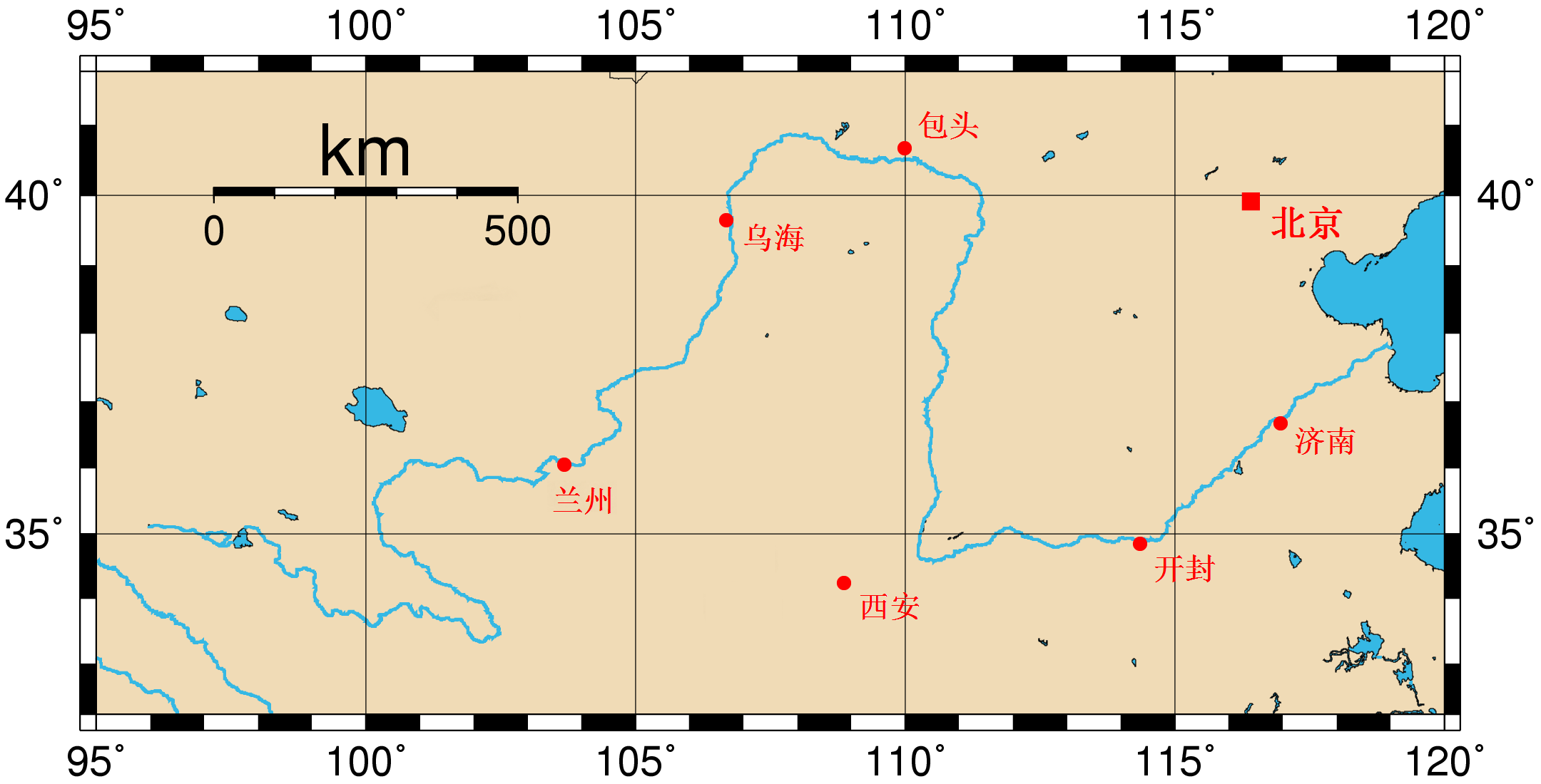
| Description | Map of the Huang He and the location of major cities along its course. This map was generated using the Generic Mapping Tools (GMT). The city coordinates (longitude, latitude) used are: *103.6833 36.0500 Lanzhou *106.6833 39.6500 Wuhai *109.9833 40.6666 Baotou *114.3500 34.8500 Kaifeng *116.9600 36.6666 Jinan *108.8666 34.2500 Xi'an *116.4166 39.9166 Beijing |
| Date | (UTC) |
| Source | |
| Author |
|
| This is a retouched picture, which means that it has been digitally altered from its original version. Modifications: Chinese Version. The original can be viewed here: Huanghemap.png:
|
I, the copyright holder of this work, hereby publish it under the following licenses:
| This file is licensed under the Creative Commons Attribution-Share Alike 3.0 Unported license. | ||
| ||
| This licensing tag was added to this file as part of the GFDL licensing update. |

|
Permission is granted to copy, distribute and/or modify this document under the terms of the GNU Free Documentation License, Version 1.2 or any later version published by the Free Software Foundation; with no Invariant Sections, no Front-Cover Texts, and no Back-Cover Texts. A copy of the license is included in the section entitled GNU Free Documentation License. |
You may select the license of your choice.
Original upload log
This image is a derivative work of the following images:
- File:Huanghemap.png licensed with Cc-by-sa-3.0-migrated, GFDL
- 2005-07-31T02:50:02Z Fanghong 2160x1100 (96391 Bytes) {{information| |Description =Map of the [[Huang He]] and the location of major cities along its course. This map was generated using the Generic Mapping Tools (GMT). The city coordinates ([[longitude]], [[latitude]]) used are
Uploaded with derivativeFX
File history
Click on a date/time to view the file as it appeared at that time.
| Date/Time | Thumbnail | Dimensions | User | Comment | |
|---|---|---|---|---|---|
| current | 01:38, 24 April 2010 | | 2,160 × 1,100 (152 KB) | Crwx | {{Information |Description=Map of the Huang He and the location of major cities along its course. This map was generated using the Generic Mapping Tools (GMT). The city coordinates (longitude, latitude) used are: *103.6833 36.0500 Lanzho |
File usage
No pages on the English Wikipedia use this file (pages on other projects are not listed).
Global file usage
The following other wikis use this file:
- Usage on zh.wikipedia.org