
File:Gold King Mine Entrance.jpg
No higher resolution available.
Gold_King_Mine_Entrance.jpg (525 × 394 pixels, file size: 82 KB, MIME type: image/jpeg)
| This is a file from the Wikimedia Commons. Information from its description page there is shown below. Commons is a freely licensed media file repository. You can help. |
Summary
| Description |
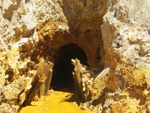
English: Entrance to Gold King Mine
County Road 52 Silverton (San Juan County), CO 81433 epaosc.org/GoldKingMine Latitude: 37.8945000 Longitude: -107.6384000 |
| Date | Unknown date |
| Source | http://epaosc.org/site/site_profile.aspx?site_id=11082 |
| Author | EPA |
| Camera location | | View this and other nearby images on: OpenStreetMap |
|---|
Licensing
This image (or other media) is a work of an Environmental Protection Agency employee, taken or made as part of that person's official duties. As works of the U.S. federal government, all EPA images are in the public domain.
|
||
File history
Click on a date/time to view the file as it appeared at that time.
| Date/Time | Thumbnail | Dimensions | User | Comment | |
|---|---|---|---|---|---|
| current | 00:14, 11 August 2015 | | 525 × 394 (82 KB) | Sadads | User created page with UploadWizard |
File usage
The following pages on the English Wikipedia use this file (pages on other projects are not listed):
Global file usage
The following other wikis use this file:
- Usage on www.wikidata.org