
File:Districts of Jharkhand map.svg

Size of this PNG preview of this SVG file: 800 × 595 pixels. Other resolutions: 320 × 238 pixels | 640 × 476 pixels | 1,024 × 762 pixels | 1,280 × 953 pixels | 2,560 × 1,905 pixels | 829 × 617 pixels.
Original file (SVG file, nominally 829 × 617 pixels, file size: 308 KB)
| This is a file from the Wikimedia Commons. Information from its description page there is shown below. Commons is a freely licensed media file repository. You can help. |
Summary
| Description |
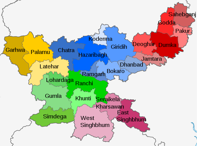
English: Map of districts of Jharkhand with divisions in different colours |
| Date | |
| Source | Derivative of File:India Jharkhand location map.svg |
| Author | Own work based on User:Milenioscuro |
Licensing
This file is licensed under the Creative Commons Attribution-Share Alike 3.0 Unported license.
- You are free:
- to share – to copy, distribute and transmit the work
- to remix – to adapt the work
- Under the following conditions:
- attribution – You must give appropriate credit, provide a link to the license, and indicate if changes were made. You may do so in any reasonable manner, but not in any way that suggests the licensor endorses you or your use.
- share alike – If you remix, transform, or build upon the material, you must distribute your contributions under the same or compatible license as the original.
File history
Click on a date/time to view the file as it appeared at that time.
| Date/Time | Thumbnail | Dimensions | User | Comment | |
|---|---|---|---|---|---|
| current | 05:21, 18 February 2021 | | 829 × 617 (308 KB) | C1MM | Uploaded a work by Own work based on User:Milenioscuro from Derivative of File:India Jharkhand location map.svg with UploadWizard |
File usage
The following pages on the English Wikipedia use this file (pages on other projects are not listed):
Global file usage
The following other wikis use this file:
- Usage on anp.wikipedia.org
- उत्तर छोटानागपुर मंडल
- कोडरमा
- कोडरमा जिला
- कोल्हान संभाग
- खुंटी
- खूंटी जिला
- गढ़वा
- गढ़वा जिला
- गिरिडीह
- गिरिडीह जिला
- गुमला
- गुमला जिला
- चतरा
- चतरा जिला
- चाईबासा
- जामतारा
- जामतारा जिला
- झारखंड के जिला सूचि
- दक्षिण छोटानागपुर मंडल
- दुमका
- दुमका जिला
- देवघर
- देवघर जिला
- धनबाद
- धनबाद जिला
- पलामू जिला
- पलामू डिवीजन
- पश्चिम सिंहभूम जिला
- पाकुर
- पाकुर जिला
- पूर्वी सिंहभूम जिला
- बोकारो जिला
- बोकारो स्टील सिटी
- मेदिनीनगर
- राँची जिला
- रामगढ़ छावनी
- रामगढ़ जिला
- लातेहार
- लातेहार जिला
- लोहरदगा
- लोहरदगा जिला
- संथाल परगना डिवीजन
- सरायकेला
- सरायकेला खरसावां जिला
- साहेबगंज
- साहेबगंज जिला
- सिमडेगा
- सिमडेगा जिला
- हजारीबाग
- हजारीबाग जिला
View more global usage of this file.