
File:Chessingtonmap.jpg
Size of this preview: 800 × 536 pixels. Other resolutions: 320 × 214 pixels | 640 × 429 pixels | 1,024 × 686 pixels | 1,280 × 857 pixels | 2,666 × 1,786 pixels.
Original file (2,666 × 1,786 pixels, file size: 1.44 MB, MIME type: image/jpeg)
Summary[edit]
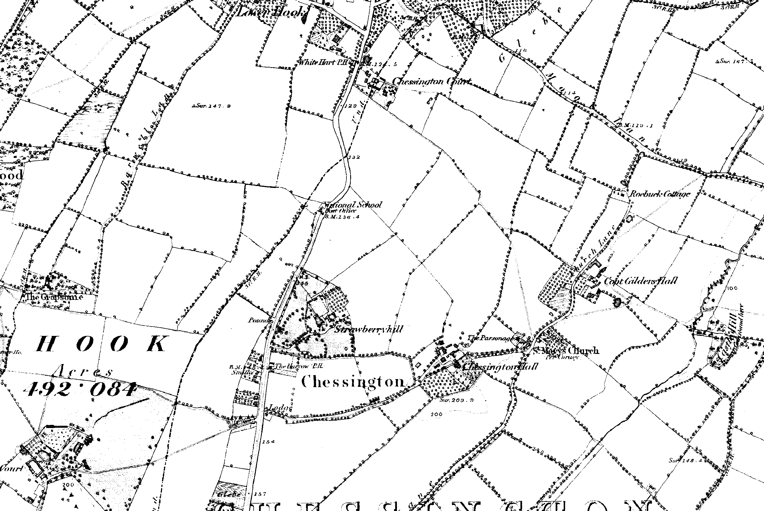
1880s 6 inch Ordnace Survey map of chessington Hall, Surrey.
Licensing[edit]
| This file is in the public domain because its copyright has expired in the United States and those countries with a copyright term of no more than the life of the author plus 100 years.
|
 | This file is a candidate to be copied to Wikimedia Commons.
Any user may perform this transfer; refer to Wikipedia:Moving files to Commons for details. If this file has problems with attribution, copyright, or is otherwise ineligible for Commons, then remove this tag and DO NOT transfer it; repeat violators may be blocked from editing. Other Instructions
| ||
| |||
File history
Click on a date/time to view the file as it appeared at that time.
| Date/Time | Thumbnail | Dimensions | User | Comment | |
|---|---|---|---|---|---|
| current | 14:49, 5 January 2006 | | 2,666 × 1,786 (1.44 MB) | Marknesbitt (talk | contribs) | 1880s 6 inch Ordnace Survey map of chessington Hall, Surrey. |
You cannot overwrite this file.
File usage
The following pages on the English Wikipedia use this file (pages on other projects are not listed):