
File:Barrow Island.png
Size of this preview: 649 × 600 pixels. Other resolutions: 260 × 240 pixels | 519 × 480 pixels | 686 × 634 pixels.
Original file (686 × 634 pixels, file size: 621 KB, MIME type: image/png)
| This is a file from the Wikimedia Commons. Information from its description page there is shown below. Commons is a freely licensed media file repository. You can help. |
Summary
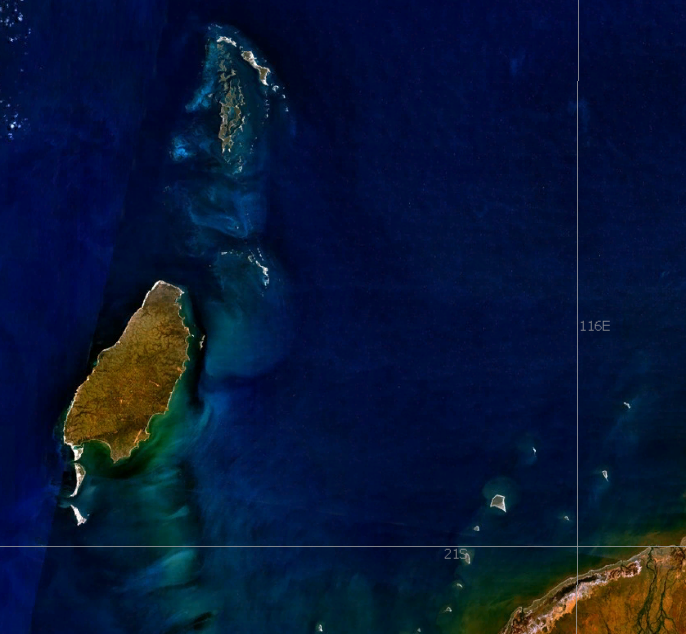
| Description | Barrow Island, Western Australia |
| Date | 13 Decemeber 2006 |
| Source | NASA World Wind |
| Author | User:Moondyne |
| Permission (Reusing this file) |
Public domain |
Licensing
| This image is in the public domain because it is a screenshot from NASA’s globe software World Wind using a public domain layer, such as Blue Marble, MODIS, Landsat, SRTM, USGS or GLOBE.
|
 |
File history
Click on a date/time to view the file as it appeared at that time.
| Date/Time | Thumbnail | Dimensions | User | Comment | |
|---|---|---|---|---|---|
| current | 07:16, 13 December 2006 | | 686 × 634 (621 KB) | Moondyne | {{Information |Description=Barrow Island, Western Australia |Source=NASA World Wind |Date=13 Decemeber 2006 |Author=User:Moondyne |Permission=Public domain |other_versions= }} == Licensing == {{PD-WorldWind}} Category:Satellite pictures of Australia |
File usage
The following pages on the English Wikipedia use this file (pages on other projects are not listed):
Global file usage
The following other wikis use this file:
- Usage on be.wikipedia.org
- Usage on ca.wikipedia.org
- Usage on da.wikipedia.org
- Usage on de.wikipedia.org
- Usage on fr.wikipedia.org
- Usage on it.wikipedia.org
- Usage on nl.wikipedia.org
- Usage on pl.wikipedia.org
- Usage on pt.wikipedia.org
- Usage on ru.wikipedia.org
- Usage on sv.wikipedia.org
- Usage on uk.wikipedia.org