
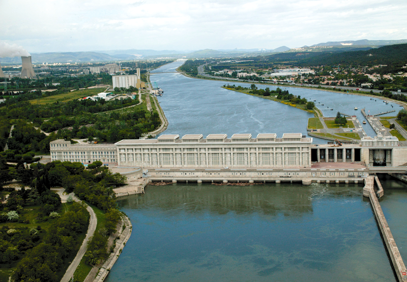
File:Barrage Donzère-Mondragon Bollène aérien.36.png

Size of this preview: 800 × 556 pixels. Other resolutions: 320 × 222 pixels | 640 × 444 pixels | 949 × 659 pixels.
Original file (949 × 659 pixels, file size: 1,015 KB, MIME type: image/png)
| This is a file from the Wikimedia Commons. Information from its description page there is shown below. Commons is a freely licensed media file repository. You can help. |
Summary
| Description |
Français : Barrage Donzère-Mondragon Bollène vue aérienne |
| Date | or before |
| Source | Own work |
| Author | Iguanebobo |
| Object location | | View this and other nearby images on: OpenStreetMap |
|---|
Licensing
| I, the copyright holder of this work, release this work into the public domain. This applies worldwide. In some countries this may not be legally possible; if so: I grant anyone the right to use this work for any purpose, without any conditions, unless such conditions are required by law. |
File history
Click on a date/time to view the file as it appeared at that time.
| Date/Time | Thumbnail | Dimensions | User | Comment | |
|---|---|---|---|---|---|
| current | 07:30, 10 March 2015 | | 949 × 659 (1,015 KB) | BlueBreezeWiki | Tonwerte, Gradation, Kontrast |
| 07:41, 17 September 2010 |  | 949 × 659 (971 KB) | Iguanebobo | {{Information |Description={{fr|1=Barrage Donzère-Mondragon Bollène vue aérienne}} |Source={{own}} |Author=Iguanebobo |Date= |Permission= |other_versions= }} |
File usage
The following pages on the English Wikipedia use this file (pages on other projects are not listed):
Global file usage
The following other wikis use this file:
- Usage on arz.wikipedia.org
- Usage on de.wikipedia.org
- Usage on el.wikipedia.org
- Usage on eo.wikipedia.org
- Usage on es.wikipedia.org
- Usage on fa.wikipedia.org
- Usage on frp.wikipedia.org
- Usage on fr.wikipedia.org
- Pierrelatte
- Canal de Donzère-Mondragon
- Barrage de Donzère-Mondragon
- Vallée du Rhône (France)
- Bollène
- Liste des monuments historiques de Vaucluse
- Liste des ponts sur le Rhône
- Liste des édifices labellisés « Patrimoine du XXe siècle » de Vaucluse
- Hydroélectricité en France
- Projet:Monuments historiques/Images de monuments français sans identifiant
- Utilisateur:Olyon01/Brouillon3
- Théo Sardnal
- Utilisateur:Olyon01/Brouillon11
- Utilisateur:Olyon01/Brouillon12
- Utilisateur:Olyon01/Brouillon13
- Usage on fr.wikivoyage.org
- Usage on no.wikipedia.org
- Usage on ru.wikipedia.org
- Usage on uk.wikipedia.org
- Usage on www.wikidata.org