
File:Attadale railway station (geograph 4922246).jpg
Size of this preview: 800 × 590 pixels. Other resolutions: 320 × 236 pixels | 640 × 472 pixels | 1,024 × 755 pixels | 1,280 × 944 pixels | 2,560 × 1,888 pixels | 2,848 × 2,100 pixels.
Original file (2,848 × 2,100 pixels, file size: 1.94 MB, MIME type: image/jpeg)
| This is a file from the Wikimedia Commons. Information from its description page there is shown below. Commons is a freely licensed media file repository. You can help. |
.jpg)
Summary
| Description |
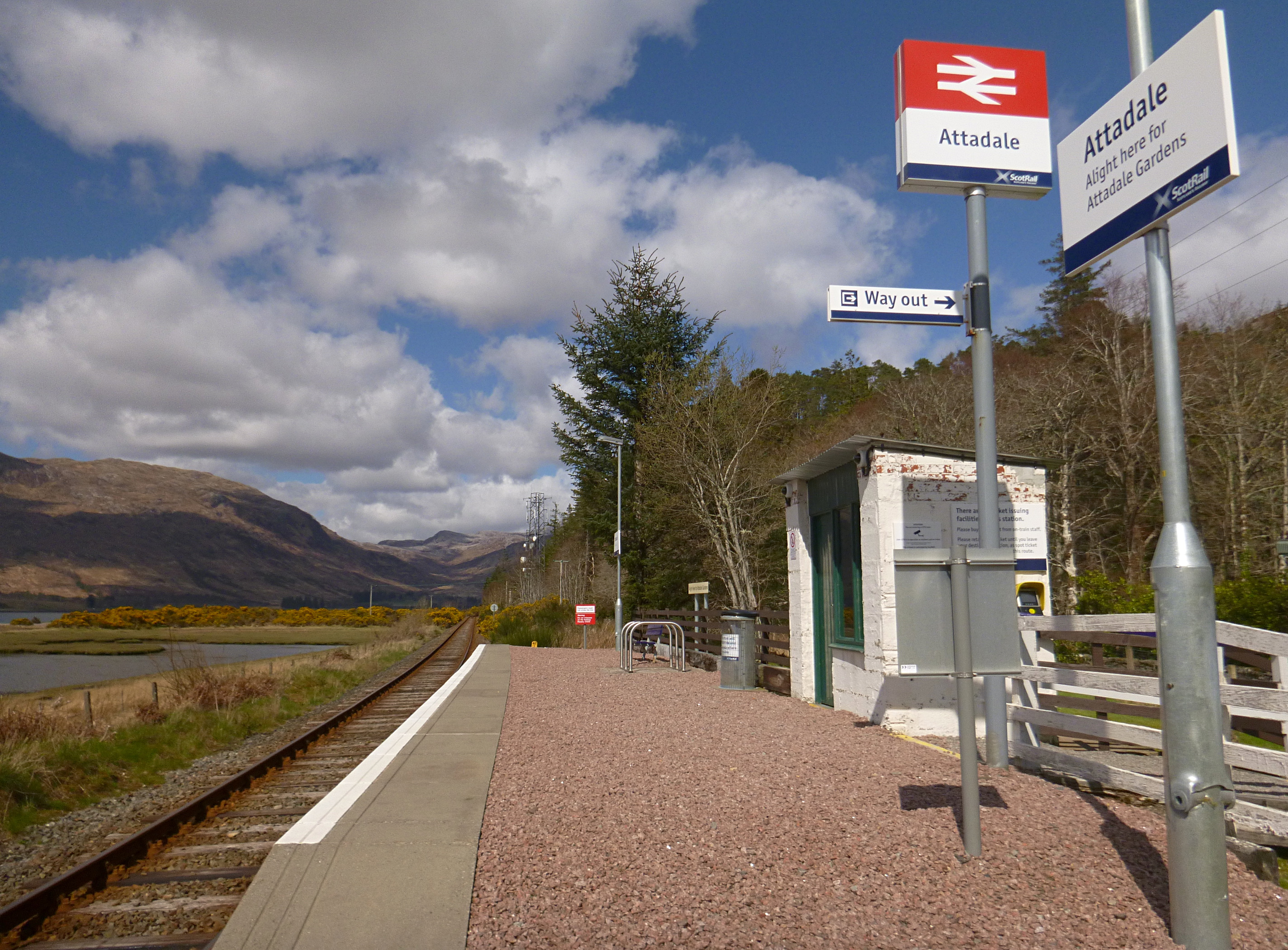
English: Attadale railway station
Attadale is a request stop on the Kyle of Lochalsh Line. The station has a small shelter, and a bike rack. The sign says "Alight here for Attadale Gardens". Looking north along the line - great views towards the mountains behind Achnashellach. |
| Date | |
| Source | From geograph.org.uk |
| Author | Craig Wallace |
| Permission (Reusing this file) |
Creative Commons Attribution Share-alike license 2.0 |
| Attribution (required by the license) | Craig Wallace / Attadale railway station / |
| Camera location | | View this and other nearby images on: OpenStreetMap |
|---|
.jpg¶ms=057.394350_N_-005.455313_E_globe:Earth_type:camera_source:geograph-osgb36(NG9246839048)_heading:0.00&language=en)
| Object location | | View this and other nearby images on: OpenStreetMap |
|---|
.jpg¶ms=057.394450_N_-005.455460_E_globe:Earth_class:object_type:object_source:geograph-osgb36(NG92463906)_heading:0.00&language=en)
Licensing

|
This image was taken from the Geograph project collection. See this photograph's page on the Geograph website for the photographer's contact details. The copyright on this image is owned by Craig Wallace and is licensed for reuse under the Creative Commons Attribution-ShareAlike 2.0 license.
|
This file is licensed under the Creative Commons Attribution-Share Alike 2.0 Generic license.
Attribution: Craig Wallace
- You are free:
- to share – to copy, distribute and transmit the work
- to remix – to adapt the work
- Under the following conditions:
- attribution – You must give appropriate credit, provide a link to the license, and indicate if changes were made. You may do so in any reasonable manner, but not in any way that suggests the licensor endorses you or your use.
- share alike – If you remix, transform, or build upon the material, you must distribute your contributions under the same or compatible license as the original.
File history
Click on a date/time to view the file as it appeared at that time.
| Date/Time | Thumbnail | Dimensions | User | Comment | |
|---|---|---|---|---|---|
| current | 23:25, 11 December 2019 | | 2,848 × 2,100 (1.94 MB) | Salen9 | Transferred from geograph.co.uk using [https://tools.wmflabs.org/geograph2commons/ geograph2commons] |
File usage
The following pages on the English Wikipedia use this file (pages on other projects are not listed):
.jpg)