
File:A470-Wales.svg

Size of this PNG preview of this SVG file: 501 × 599 pixels. Other resolutions: 201 × 240 pixels | 401 × 480 pixels | 642 × 768 pixels | 856 × 1,024 pixels | 1,713 × 2,048 pixels | 1,047 × 1,252 pixels.
Original file (SVG file, nominally 1,047 × 1,252 pixels, file size: 563 KB)
| This is a file from the Wikimedia Commons. Information from its description page there is shown below. Commons is a freely licensed media file repository. You can help. |
Summary
| Description |
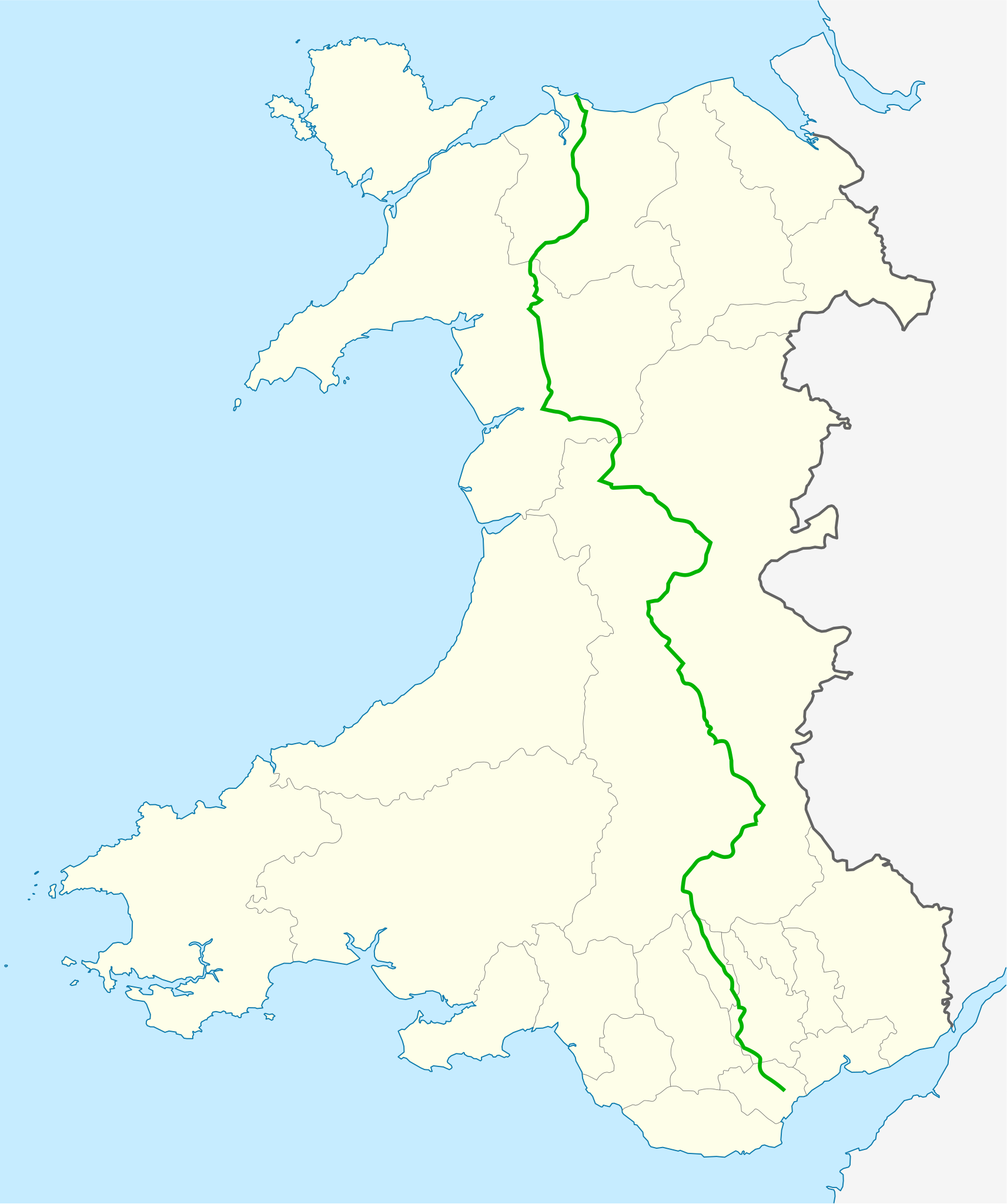
Deutsch: Positionskarte von der A470(T) drinnen Wales, Vereinigtes Königreich. Quadratische Plattkarte, N-S-Streckung 163 %. Geographische Begrenzung der Karte:
English: Location map of the A470(T) within Wales, United Kingdom. Equirectangular projection, N/S stretching 163 %. Geographic limits of the map:
|
| Date | (UTC) |
| Source |
This file was derived from: Wales location map.svg:  |
| Author |
|
Licensing
I, the copyright holder of this work, hereby publish it under the following license:
This file is licensed under the Creative Commons Attribution-Share Alike 3.0 Unported license.
- You are free:
- to share – to copy, distribute and transmit the work
- to remix – to adapt the work
- Under the following conditions:
- attribution – You must give appropriate credit, provide a link to the license, and indicate if changes were made. You may do so in any reasonable manner, but not in any way that suggests the licensor endorses you or your use.
- share alike – If you remix, transform, or build upon the material, you must distribute your contributions under the same or compatible license as the original.
Original upload log
This image is a derivative work of the following images:
- File:Wales_location_map.svg licensed with Cc-by-sa-3.0
- 2009-06-24T13:27:54Z NordNordWest 1047x1252 (242334 Bytes) {{Information |Description= {{de|Positionskarte von [[:de:Wales|Wales]], [[:de:Vereinigtes Königreich|Vereinigtes Königreich]]}} Quadratische Plattkarte, N-S-Streckung 163 %. Geographische Begrenzung der Karte: * N: 53.5°
Uploaded with derivativeFX
File history
Click on a date/time to view the file as it appeared at that time.
| Date/Time | Thumbnail | Dimensions | User | Comment | |
|---|---|---|---|---|---|
| current | 19:01, 23 March 2012 | | 1,047 × 1,252 (563 KB) | Alphathon | == {{int:filedesc}} == {{Information |Description={{de|Positionskarte von der A470(T) drinnen Wales, Vereinigtes Königreich. Quadratische Plattkarte, N-S-Streckung 163 %. Geographische Begrenzung der ... |
File usage
The following pages on the English Wikipedia use this file (pages on other projects are not listed):
Global file usage
The following other wikis use this file: