
File:113 kaiser-wilhelms-land-bismarck-archipel-und-samoa-inseln (1905).png
Size of this preview: 800 × 497 pixels. Other resolutions: 320 × 199 pixels | 640 × 398 pixels | 1,024 × 636 pixels | 1,280 × 795 pixels | 1,761 × 1,094 pixels.
Original file (1,761 × 1,094 pixels, file size: 1.23 MB, MIME type: image/png)
| This is a file from the Wikimedia Commons. Information from its description page there is shown below. Commons is a freely licensed media file repository. You can help. |
.png)
Summary
| Description |
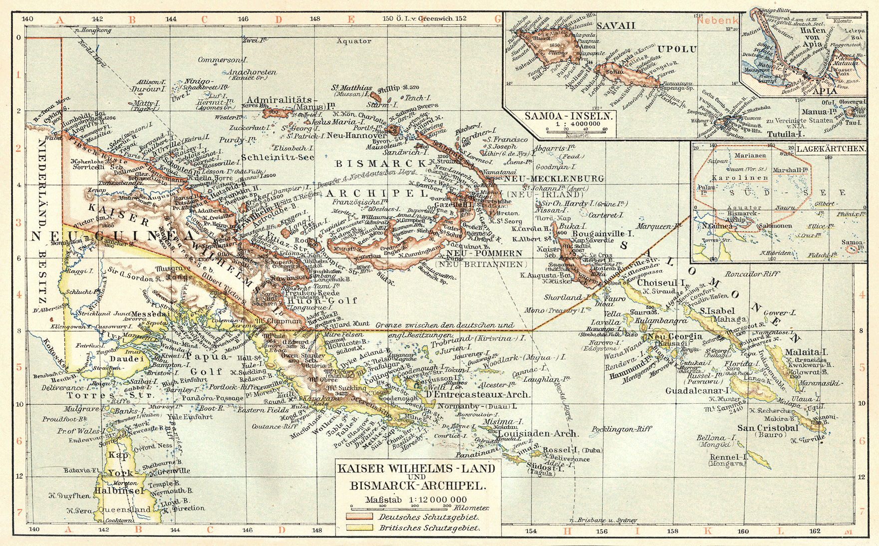
Deutsch: Kaiser Wilhelms-Land, Bismarck Archipel und Samoa Inseln (1905)
English: Kaiser-Wilhelmsland, Bismarck Archipelago and Samoan Islands (1905)
Slovenčina: Zem cisára Wilhelma, Bismarckovo súostrovie a ostrovy Samoa (1905) |
| Date | |
| Source | Meyers Geographischer Hand-Atlas |
| Author | Meyer, Hermann Julius (1826–1909); Bibliographisches Institut Leipzig |
Licensing
|
The author died in 1909, so this work is in the public domain in its country of origin and other countries and areas where the copyright term is the author's life plus 100 years or fewer. This work is in the public domain in the United States because it was published (or registered with the U.S. Copyright Office) before January 1, 1929. | |
| This file has been identified as being free of known restrictions under copyright law, including all related and neighboring rights. | |
File history
Click on a date/time to view the file as it appeared at that time.
| Date/Time | Thumbnail | Dimensions | User | Comment | |
|---|---|---|---|---|---|
| current | 09:26, 25 July 2010 | | 1,761 × 1,094 (1.23 MB) | 14nu5 | {{Information |Description={{en|1=Kaiser-Wilhelmsland, Bismarck Archipelago and Samoan Islands (1905)}} {{de|1=Kaiser Wilhelms-Land, Bismarck Archipel und Samoa Inseln (1905)}} {{sk|1=Zem cisára Wilhelma, Bismarckovo súostrovie a ostrovy Samoa (1905)}} |
File usage
The following pages on the English Wikipedia use this file (pages on other projects are not listed):
.png)