
Whiterocks, Utah
Whiterocks | |
|---|---|
 Location in Uintah County and the state of Utah | |
| Coordinates: 40°28′3″N 109°55′47″W / 40.46750°N 109.92972°W | |
| Country | United States |
| State | Utah |
| County | Uintah |
| Founded | 1868 |
| Named for | Whiterocks River |
| Area | |
| • Total | 2.4 sq mi (6.1 km2) |
| • Land | 2.4 sq mi (6.1 km2) |
| • Water | 0.0 sq mi (0.0 km2) |
| Elevation | 6,033 ft (1,839 m) |
| Population (2000) | |
| • Total | 341 |
| • Density | 145.1/sq mi (56.0/km2) |
| Time zone | UTC-7 (Mountain (MST)) |
| • Summer (DST) | UTC-6 (MDT) |
| ZIP code | 84085 |
| Area code | 435 |
| FIPS code | 49-84160[1] |
| GNIS feature ID | 1434208[2] |
Whiterocks is a census-designated place (CDP) in Uintah County, Utah, United States. The population was 341 at the 2000 census, a slight increase over the 1990 population of 312.
Geography[edit]
Whiterocks is located at 40°28′3″N 109°55′47″W / 40.46750°N 109.92972°W (40.467560, -109.929607).[3]
According to the United States Census Bureau, the CDP has a total area of 2.3 square miles (6.0 km2), all land.
Demographics[edit]
| Census | Pop. | Note | %± |
|---|---|---|---|
| 1910 | 1,349 | — | |
| 1920 | 232 | −82.8% | |
| 1930 | 784 | 237.9% | |
| 1940 | 601 | −23.3% | |
| 1950 | 481 | −20.0% | |
| 1990 | 312 | — | |
| 2000 | 341 | 9.3% | |
| 2010 | 289 | −15.2% | |
| Source: U.S. Census Bureau[4] | |||
As of the census[1] of 2000, there were 341 people, 92 households, and 78 families residing in the CDP. The population density was 145.1 people per square mile (56.0/km2). There were 96 housing units at an average density of 40.8/sq mi (15.8/km2). The racial makeup of the CDP was 5.57% White, 93.84% Native American, and 0.59% from two or more races. Hispanic or Latino of any race were 0.88% of the population.
There were 92 households, out of which 47.8% had children under the age of 18 living with them, 31.5% were married couples living together, 47.8% had a female householder with no husband present, and 15.2% were non-families. 10.9% of all households were made up of individuals, and 1.1% had someone living alone who was 65 years of age or older. The average household size was 3.71 and the average family size was 4.03.
In the CDP, the population was spread out, with 41.6% under the age of 18, 13.2% from 18 to 24, 25.8% from 25 to 44, 15.8% from 45 to 64, and 3.5% who were 65 years of age or older. The median age was 22 years. For every 100 females, there were 80.4 males. For every 100 females age 18 and over, there were 76.1 males.
The median income for a household in the CDP was $10,417, and the median income for a family was $15,156. Males had a median income of $21,750 versus $15,833 for females. The per capita income for the CDP was $3,920. About 63.4% of families and 70.9% of the population were below the poverty line, including 81.1% of those under age 18 and 90.0% of those age 65 or over.
History[edit]
1828 Four men, William "Toopeechee" Reed, Jim Reed, Dennis Julien, and Augustus Archambeaux, French traders from Kentucky, entered the Uintah Basin and set up a trading post near a spring of water just south and east of the present settlement of Whiterocks. The site was at a junction of trails used by the local Ute people. They brought in the first butcher knives, coffee beans, and other articles traded to the locals for fur. Antoine Rubidoux purchased the enterprise in 1832 and built a larger "fort" just east of the post. Fort Robidoux, a center for fur traders, had a life of 12 years. In 1844, this fort was burned to the ground.
October 3, 1861 By order of Abraham Lincoln and the secretary of the Interior the "Uintah Valley in the Territory of Utah, be set apart and reserved for the use and occupancy of Indian Tribes."[5]
1868 Amos Reed, a government clerk in the employment of the Indian Service, made a trip to White Rocks. His guide, Chief Antero, said that since he was to be moved to the Uintah Reservation he would choose White Rocks for his home, and he suggested to Mr. Reed that the Indian Agency be established at that place. His reason for his choice was the fact that White Rocks was located in the center of the Basin. Here the local Utes were used to staying. Here traders and trappers had established posts and headquarters. Many trails led to and from it, and here the site had a lovely natural setting. On the recommendation of Chief Antero the agency was moved from Rock Creek to Whiterocks on Christmas Day 1868.
Archaeology[edit]
Whiterocks is near the site of the eponymous "Whiterocks Village," a Uinta Fremont village partially excavated in 1966 by Wayne F. Shields, assigned on the basis of architecture and radiocarbon dates to the Whiterocks Phase, A.D. 800-950. The excavated portion consisted of four round pithouses, 12-18 square feet in size, and a rectangular granary 25 by 29.5 feet in dimensions featuring coursed adobe walls. Of the four dwellings, two had masonry walls and central firepits, while the other two had single stone walls and no firepits.[6] One fragmentary burial with two disarticulated skeletons was reportedly found but not described in the published report.[7][6]
The site is notable for a high frequency of Uinta Gray pottery sherds; 5,675 potsherds were recovered, 5,540 of which were interpreted as Uinta Gray, a diagnostic style of the Uinta Fremont characterized by calcite temper.[8][9] Other artifacts included chipped and ground stone tools, shells, nine corncobs, beans, and bone tools.[6]
The site is on the National Register of Historic Places. Much of the surface of the site was under cultivation at the time of excavation and was presumed to have been largely destroyed by agricultural activity.[7]
See also[edit]
References[edit]
- ^ a b "U.S. Census website". United States Census Bureau. Retrieved January 31, 2008.
- ^ "US Board on Geographic Names". United States Geological Survey. October 25, 2007. Retrieved January 31, 2008.
- ^ "US Gazetteer files: 2010, 2000, and 1990". United States Census Bureau. February 12, 2011. Retrieved April 23, 2011.
- ^ "Census of Population and Housing". U.S. Census Bureau. Retrieved November 18, 2011.
- ^ Caleb B. Smith Secretary of the Interior, October 3, 1861
- ^ a b c Ambler, John Richard (1971). "Review of Miscellaneous Collected Papers 15-18; Wayne F. Shields et al, Department of Anthropology, University of Utah Anthropological Papers no. 89, University of Utah Press, Salt Lake City, 1969". American Antiquity. 36 (2): 227–228. doi:10.2307/278691. JSTOR 278691. Retrieved May 4, 2021.
- ^ a b National Register of Historic Places Inventory Nomination Form for Whiterocks Village (42 UN 170) https://collections.lib.utah.edu/file?id=1225794 Retrieved 4 May 2021
- ^ Truesdale, James A.; Hill, David V. (1999). "A Reevaluation of the Fremont Uinta Gray Pottery From Dinosaur National Monument, Utah/Colorado" (PDF). Retrieved May 4, 2021.
{{cite journal}}: Cite journal requires|journal=(help) - ^ Watkins, Christopher N. (2009). "Type, Series, and Ware: Characterizing Variability in Fremont Ceramic Temper". Journal of California and Great Basin Anthropology. 29 (2): 145–162. JSTOR 27825914. Retrieved May 4, 2021.
External links[edit]
![]() Media related to Whiterocks, Utah at Wikimedia Commons
Media related to Whiterocks, Utah at Wikimedia Commons
Municipalities and communities of Uintah County, Utah, United States | ||
|---|---|---|
| Cities | 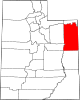 | |
| CDPs | ||
| Other communities | ||
| Indian reservation | ||
| Ghost town | ||
| Footnotes | ‡This populated place also has portions in an adjacent county or counties | |
| International | |
|---|---|
| National | |