
West Crossett, Arkansas
West Crossett, Arkansas | |
|---|---|
 Location in Ashley County and the state of Arkansas | |
| Coordinates: 33°8′18″N 92°0′35″W / 33.13833°N 92.00972°W | |
| Country | United States |
| State | Arkansas |
| County | Ashley |
| Area | |
| • Total | 11.90 sq mi (30.83 km2) |
| • Land | 11.89 sq mi (30.80 km2) |
| • Water | 0.01 sq mi (0.02 km2) |
| Elevation | 151 ft (46 m) |
| Population (2020) | |
| • Total | 1,144 |
| • Density | 96.19/sq mi (37.14/km2) |
| Time zone | UTC-6 (Central (CST)) |
| • Summer (DST) | UTC-5 (CDT) |
| ZIP code | 71635 |
| Area code | 870 |
| FIPS code | 05-74270 |
| GNIS feature ID | 0058849 |
West Crossett is a census-designated place (CDP) in Ashley County, Arkansas, United States. Per the 2020 census, the population was 1,144.[2]
Geography[edit]
West Crossett is located at 33°8′18″N 92°0′35″W / 33.13833°N 92.00972°W (33.138278, -92.009710).[3]
According to the United States Census Bureau, the CDP has a total area of 11.9 square miles (31 km2), of which 11.9 square miles (31 km2) is land and 0.01 square miles (0.026 km2) (.08%) is water.
Demographics[edit]
| Census | Pop. | Note | %± |
|---|---|---|---|
| 2010 | 1,256 | — | |
| 2020 | 1,144 | −8.9% | |
| U.S. Decennial Census[4] 2010[5] 2020[6] | |||
2020 census[edit]
| Race / Ethnicity | Pop 2010[5] | Pop 2020[6] | % 2010 | % 2020 |
|---|---|---|---|---|
| White alone (NH) | 794 | 730 | 63.22% | 63.81% |
| Black or African American alone (NH) | 419 | 359 | 33.36% | 31.38% |
| Native American or Alaska Native alone (NH) | 0 | 3 | 0.00% | 0.26% |
| Asian alone (NH) | 0 | 3 | 0.00% | 0.17% |
| Pacific Islander alone (NH) | 0 | 0 | 0.00% | 0.00% |
| Some Other Race alone (NH) | 0 | 9 | 0.00% | 0.79% |
| Mixed Race/Multi-Racial (NH) | 15 | 24 | 1.19% | 2.10% |
| Hispanic or Latino (any race) | 28 | 17 | 2.23% | 1.49% |
| Total | 1,256 | 1,144 | 100.00% | 100.00% |
2000 Census[edit]
As of the census[7] of 2000, there were 1,664 people, 661 households, and 485 families residing in the CDP. The population density was 102.5 inhabitants per square mile (39.6/km2). There were 774 housing units at an average density of 47.7 per square mile (18.4/km2). The racial makeup of the CDP was 60.88% White, 36.72% Black or African American, 0.06% Native American, 0.06% Asian, 1.74% from other races, and 0.54% from two or more races. 3.06% of the population were Hispanic or Latino of any race.
There were 661 households, out of which 33.1% had children under the age of 18 living with them, 57.0% were married couples living together, 12.0% had a female householder with no husband present, and 26.5% were non-families. 22.8% of all households were made up of individuals, and 8.2% had someone living alone who was 65 years of age or older. The average household size was 2.52 and the average family size was 2.95.
In the CDP, the population was spread out, with 25.7% under the age of 18, 8.0% from 18 to 24, 27.3% from 25 to 44, 26.6% from 45 to 64, and 12.4% who were 65 years of age or older. The median age was 38 years. For every 100 females, there were 96.9 males. For every 100 females age 18 and over, there were 98.1 males.
The median income for a household in the CDP was $35,089, and the median income for a family was $37,763. Males had a median income of $34,500 versus $21,406 for females. The per capita income for the CDP was $15,759. About 9.5% of families and 11.7% of the population were below the poverty line, including 9.3% of those under age 18 and 12.0% of those age 65 or over.
Education[edit]
The community is in the Crossett School District, which operates Crossett High School.[8]
References[edit]
- ^ "2020 U.S. Gazetteer Files". United States Census Bureau. Retrieved October 29, 2021.
- ^ "West Crossett CDP, Arkansas". United States Census Bureau. Retrieved April 15, 2022.
- ^ "US Gazetteer files: 2010, 2000, and 1990". United States Census Bureau. February 12, 2011. Retrieved April 23, 2011.
- ^ "Decennial Census of Population and Housing by Decades". US Census Bureau.
- ^ a b "P2 HISPANIC OR LATINO, AND NOT HISPANIC OR LATINO BY RACE – 2010: DEC Redistricting Data (PL 94-171) – West Crossett CDP, Arkansas". United States Census Bureau.
- ^ a b "P2 HISPANIC OR LATINO, AND NOT HISPANIC OR LATINO BY RACE – 2020: DEC Redistricting Data (PL 94-171) – West Crossett CDP, Arkansas". United States Census Bureau.
- ^ "U.S. Census website". United States Census Bureau. Retrieved January 31, 2008.
- ^ "SCHOOL DISTRICT REFERENCE MAP (2010 CENSUS): Ashley County, AR." U.S. Census Bureau. Retrieved on June 17, 2018.
Municipalities and communities of Ashley County, Arkansas, United States | ||
|---|---|---|
| Cities | 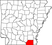 | |
| Town | ||
| CDPs | ||
| Unincorporated communities | ||