
Wade Hampton, South Carolina
Wade Hampton, South Carolina | |
|---|---|
 Wade Hampton, South Carolina Location of Wade Hampton, South Carolina | |
| Coordinates: 34°52′59″N 82°20′0″W / 34.88306°N 82.33333°W | |
| Country | United States |
| State | South Carolina |
| County | Greenville |
| Area | |
| • Total | 8.92 sq mi (23.10 km2) |
| • Land | 8.88 sq mi (23.01 km2) |
| • Water | 0.04 sq mi (0.09 km2) |
| Elevation | 1,024 ft (312 m) |
| Population | |
| • Total | 21,482 |
| • Density | 2,418.05/sq mi (933.66/km2) |
| Time zone | UTC−5 (Eastern (EST)) |
| • Summer (DST) | UTC−4 (EDT) |
| FIPS code | 45-73870[4] |
| GNIS feature ID | 1245371[2] |
Wade Hampton is a census-designated place (CDP) in Greenville County, South Carolina, United States. The population was 20,622 at the 2010 census.[5] It is named for American Civil War general and South Carolina governor Wade Hampton.
Wade Hampton is part of the Greenville–Mauldin–Easley Metropolitan Statistical Area.
Geography[edit]
Wade Hampton is located in central Greenville County at 34°52′59″N 82°20′0″W / 34.88306°N 82.33333°W (34.883084, -82.333227).[6] It is bordered to the southwest by the city of Greenville and to the northeast by Taylors, an unincorporated community. U.S. Route 29 (Wade Hampton Boulevard) passes through the CDP, leading southwest 5 miles (8 km) to the center of Greenville and northeast 7 miles (11 km) to Greer.
According to the United States Census Bureau, the CDP has a total area of 9.0 square miles (23.3 km2), of which 9.0 square miles (23.2 km2) are land and 0.04 square miles (0.1 km2), or 0.55%, are water.[5]
Demographics[edit]
| Census | Pop. | Note | %± |
|---|---|---|---|
| 2020 | 21,482 | — | |
| U.S. Decennial Census[7] | |||
2020 census[edit]
| Race | Num. | Perc. |
|---|---|---|
| White (non-Hispanic) | 14,762 | 68.72% |
| Black or African American (non-Hispanic) | 2,186 | 10.18% |
| Native American | 41 | 0.19% |
| Asian | 680 | 3.17% |
| Pacific Islander | 18 | 0.08% |
| Other/Mixed | 873 | 4.06% |
| Hispanic or Latino | 2,922 | 13.6% |
As of the 2020 United States census, there were 21,482 people, 9,016 households, and 5,368 families residing in the CDP.
2000 census[edit]
As of the census[4] of 2000, there were 20,458 people, 9,210 households, and 5,645 families residing in the CDP. The population density was 2,331.4 inhabitants per square mile (900.2/km2). There were 9,793 housing units at an average density of 1,116.0 per square mile (430.9/km2). The racial makeup of the CDP was 84.85% White, 8.08% African American, 0.18% Native American, 3.34% Asian, 0.06% Pacific Islander, 2.39% from other races, and 1.11% from two or more races. Hispanic or Latino of any race were 6.13% of the population.
There were 9,210 households, out of which 22.9% had children under the age of 18 living with them, 49.4% were married couples living together, 9.0% had a female householder with no husband present, and 38.7% were non-families. 32.7% of all households were made up of individuals, and 10.8% had someone living alone who was 65 years of age or older. The average household size was 2.21 and the average family size was 2.81.
In the CDP, the population was spread out, with 19.0% under the age of 18, 9.6% from 18 to 24, 28.9% from 25 to 44, 24.3% from 45 to 64, and 18.2% who were 65 years of age or older. The median age was 40 years. For every 100 females, there were 93.8 males. For every 100 females age 18 and over, there were 90.9 males.
The median income for a household in the CDP was $40,487, and the median income for a family was $54,106. Males had a median income of $40,528 versus $27,613 for females. The per capita income for the CDP was $26,376. About 6.4% of families and 9.0% of the population were below the poverty line, including 10.9% of those under age 18 and 5.3% of those age 65 or over.
Education[edit]
This section needs expansion. You can help by adding to it. (May 2014) |
The French Bilingual School of South Carolina is located in Wade Hampton.[9][10]
The Greenville Saturday School (グリーンビル日本語補習授業校 Gurīnbiru Nihongo Hoshū Jugyō Kō), a Japanese Saturday supplementary school, holds its classes at the French Bilingual School.[11] The school was scheduled to open in 1989.[12] The school received $2,500 from the city council of Greenville.[13]
References[edit]
- ^ "ArcGIS REST Services Directory". United States Census Bureau. Retrieved October 15, 2022.
- ^ a b U.S. Geological Survey Geographic Names Information System: Wade Hampton, South Carolina
- ^ "Census Population API". United States Census Bureau. Retrieved October 15, 2022.
- ^ a b "U.S. Census website". United States Census Bureau. Retrieved January 31, 2008.
- ^ a b "Geographic Identifiers: 2010 Demographic Profile Data (G001): Wade Hampton CDP, South Carolina". American Factfinder. U.S. Census Bureau. Retrieved February 15, 2017.[dead link]
- ^ "US Gazetteer files: 2010, 2000, and 1990". United States Census Bureau. February 12, 2011. Retrieved April 23, 2011.
- ^ "Census of Population and Housing". Census.gov. Retrieved June 4, 2016.
- ^ "Explore Census Data". data.census.gov. Retrieved December 14, 2021.
- ^ "FRENCH BILINGUAL SCHOOL OF SOUTH CAROLINA" (Archive) Association of French Schools in America. Retrieved on May 11, 2014. "Address: 2 Fisher road City: Greenville, SC State/Province: SC, 29615"
- ^ "2010 CENSUS - CENSUS BLOCK MAP: Wade Hampton CDP, SC" (Archive). U.S. Census Bureau. Retrieved on May 11, 2014.
- ^ "GSSへのDirection" (Archive). Greenville Saturday School. Retrieved on May 11, 2014.
- ^ "Greenville school to meet need of Japanese youths". The State. Columbia, South Carolina. Associated Press. December 30, 1988. p. 4-C. - Clipping from Newspapers.com.
- ^ "Japanese Kids Get Saturday School". The Charlotte Observer. Charlotte, North Carolina. Associated Press. December 29, 1988. pp. 1C, 4C. - Clipping of first and of second page from Newspapers.com.
Municipalities and communities of Greenville County, South Carolina, United States | ||
|---|---|---|
| Cities | 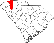 | |
| CDPs | ||
| Other communities | ||
| Footnotes | ‡This populated place also has portions in an adjacent county or counties | |