
Tooma, New South Wales
| Tooma New South Wales | |||||||||
|---|---|---|---|---|---|---|---|---|---|
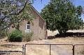
 The It's Not a Tooma Inn aka The Three Stags Inn | |||||||||
 Tooma | |||||||||
| Coordinates | 35°58′0″S 148°4′0″E / 35.96667°S 148.06667°E | ||||||||
| Population | 104 (2016 census)[1] | ||||||||
| Postcode(s) | 2642 | ||||||||
| Elevation | 331 m (1,086 ft) | ||||||||
| Location |
| ||||||||
| LGA(s) | Snowy Valleys Council | ||||||||
| County | Selwyn | ||||||||
| State electorate(s) | Albury | ||||||||
| Federal division(s) | Eden-Monaro | ||||||||
| |||||||||
Tooma is a locality and village community in the Snowy Valleys Council local government area, in the eastern part of the Riverina region of New South Wales.
Location[edit]
Tooma is in the valley of the Tooma River, not far from its confluence with the Murray River. The village is adjacent to Tumbarumba Creek, a tributary of the Tooma River. It is about 11 kilometres (6.8 mi) east of Welaregang and 34 kilometres (21 mi) south of Tumbarumba.
History[edit]
Tooma Post Office opened on 1 January 1873.[2] A school opened in Tooma in February 1876 and closed in August 1980.[3]
The Tooma District was one of ten locations that were shortlisted for the site of Australia's national capital in 1900. It was one of the last to be eliminated. In the final series of parliamentary ballots in October 1908, Tooma was one of the eleven sites in contention, and it survived until the eighth of the nine ballots, after which only Dalgety and the eventual capital site 'Yass Canberra' remained in contention. The site for the city was identified as being at nearby Welaregang.[4][5][6][7][8]
Climate[edit]
Climate data for Tooma are sourced at nearby Khancoban of approximately the same altitude. Summers are hot and dry, winters cool and rainy with occasional snowfalls.
| Climate data for Khancoban SMHEA (1961–1994); 337 m AMSL; 36.23° S, 148.14° E | |||||||||||||
|---|---|---|---|---|---|---|---|---|---|---|---|---|---|
| Month | Jan | Feb | Mar | Apr | May | Jun | Jul | Aug | Sep | Oct | Nov | Dec | Year |
| Record high °C (°F) | 41.7 (107.1) |
41.7 (107.1) |
37.6 (99.7) |
34.4 (93.9) |
26.4 (79.5) |
20.0 (68.0) |
19.5 (67.1) |
23.3 (73.9) |
28.3 (82.9) |
30.8 (87.4) |
38.5 (101.3) |
39.1 (102.4) |
41.7 (107.1) |
| Mean daily maximum °C (°F) | 29.7 (85.5) |
29.7 (85.5) |
26.4 (79.5) |
21.2 (70.2) |
15.7 (60.3) |
11.6 (52.9) |
11.0 (51.8) |
13.1 (55.6) |
16.3 (61.3) |
20.2 (68.4) |
23.7 (74.7) |
27.0 (80.6) |
20.5 (68.9) |
| Mean daily minimum °C (°F) | 12.8 (55.0) |
13.0 (55.4) |
10.4 (50.7) |
7.0 (44.6) |
4.2 (39.6) |
1.8 (35.2) |
1.3 (34.3) |
2.6 (36.7) |
4.4 (39.9) |
6.8 (44.2) |
8.9 (48.0) |
11.3 (52.3) |
7.0 (44.7) |
| Record low °C (°F) | 1.8 (35.2) |
3.5 (38.3) |
−0.6 (30.9) |
−2.4 (27.7) |
−4.1 (24.6) |
−8.0 (17.6) |
−6.4 (20.5) |
−5.6 (21.9) |
−3.9 (25.0) |
−1.8 (28.8) |
−0.4 (31.3) |
1.1 (34.0) |
−8.0 (17.6) |
| Average precipitation mm (inches) | 59.8 (2.35) |
53.0 (2.09) |
56.0 (2.20) |
63.3 (2.49) |
80.6 (3.17) |
84.9 (3.34) |
100.9 (3.97) |
112.9 (4.44) |
97.9 (3.85) |
96.8 (3.81) |
81.7 (3.22) |
75.7 (2.98) |
963.5 (37.91) |
| Average precipitation days (≥ 0.2 mm) | 7.4 | 7.1 | 7.1 | 9.0 | 11.9 | 14.7 | 15.9 | 16.0 | 14.5 | 12.4 | 10.7 | 9.2 | 135.9 |
| Average afternoon relative humidity (%) | 34 | 34 | 37 | 48 | 61 | 71 | 68 | 59 | 55 | 48 | 43 | 42 | 50 |
| Mean monthly sunshine hours | 303.8 | 268.4 | 257.3 | 210.0 | 145.7 | 99.0 | 108.5 | 136.4 | 177.0 | 235.6 | 261.0 | 269.7 | 2,472.4 |
| Source: Australian Bureau of Meteorology; Khancoban SMHEA | |||||||||||||
| Climate data for Khancoban AWS (1997–2022); 339 m AMSL; 36.23° S, 148.14° E | |||||||||||||
|---|---|---|---|---|---|---|---|---|---|---|---|---|---|
| Month | Jan | Feb | Mar | Apr | May | Jun | Jul | Aug | Sep | Oct | Nov | Dec | Year |
| Record high °C (°F) | 43.3 (109.9) |
43.3 (109.9) |
38.0 (100.4) |
32.5 (90.5) |
25.4 (77.7) |
20.0 (68.0) |
19.0 (66.2) |
22.1 (71.8) |
28.0 (82.4) |
33.8 (92.8) |
38.0 (100.4) |
41.1 (106.0) |
43.3 (109.9) |
| Mean daily maximum °C (°F) | 31.7 (89.1) |
30.3 (86.5) |
27.0 (80.6) |
21.7 (71.1) |
16.0 (60.8) |
12.2 (54.0) |
11.7 (53.1) |
13.6 (56.5) |
17.2 (63.0) |
21.0 (69.8) |
25.0 (77.0) |
28.4 (83.1) |
21.3 (70.4) |
| Mean daily minimum °C (°F) | 13.7 (56.7) |
13.3 (55.9) |
10.7 (51.3) |
7.3 (45.1) |
4.2 (39.6) |
2.2 (36.0) |
1.7 (35.1) |
2.7 (36.9) |
4.6 (40.3) |
6.6 (43.9) |
9.5 (49.1) |
11.3 (52.3) |
7.3 (45.2) |
| Record low °C (°F) | 4.0 (39.2) |
3.0 (37.4) |
−2.0 (28.4) |
−1.4 (29.5) |
−4.0 (24.8) |
−4.2 (24.4) |
−4.6 (23.7) |
−5.0 (23.0) |
−7.0 (19.4) |
−1.3 (29.7) |
0.0 (32.0) |
2.2 (36.0) |
−7.0 (19.4) |
| Average precipitation mm (inches) | 60.0 (2.36) |
60.2 (2.37) |
63.2 (2.49) |
57.3 (2.26) |
68.7 (2.70) |
95.8 (3.77) |
89.0 (3.50) |
106.5 (4.19) |
88.6 (3.49) |
80.4 (3.17) |
92.2 (3.63) |
74.6 (2.94) |
936.5 (36.87) |
| Average precipitation days (≥ 0.2 mm) | 7.7 | 7.9 | 8.5 | 8.8 | 14.6 | 19.6 | 20.2 | 18.3 | 14.2 | 11.8 | 11.1 | 9.3 | 152.0 |
| Average afternoon relative humidity (%) | 31 | 33 | 34 | 43 | 57 | 69 | 69 | 61 | 55 | 49 | 43 | 35 | 48 |
| Source: Australian Bureau of Meteorology; Khancoban AWS | |||||||||||||
Gallery[edit]
-
 Looking down upon Tooma from the Welaregang Road.
 -
 Tooma - Church of Our Lady of Perpetual Succor.


See also[edit]
References[edit]
- ^ Australian Bureau of Statistics (27 June 2017). "Tooma (State Suburb)". 2016 Census QuickStats. Retrieved 29 June 2017.
- ^ Premier Postal History, Post Office List, retrieved 11 June 2009
- ^ "Tooma". nswgovschoolhistory.cese.nsw.gov.au. Retrieved 20 December 2020.
- ^ Chesterman, A.H. (20 July 1904). "Federal Capital Proposed Sites. Tooma District". Trove. The Parliament of the Commonwealth of Australia. Retrieved 13 September 2020.
- ^ "FEDERAL AFFAIRS". Leader (Melbourne, Vic. : 1862 - 1918, 1935). 23 July 1904. p. 24. Retrieved 13 September 2020.
- ^ "FEDERAL CAPITAL". Herald (Melbourne, Vic. : 1861 - 1954). 30 March 1908. p. 6. Retrieved 13 September 2020.
- ^ "AUSTRALIA'S CAPITAL". Sydney Morning Herald. 9 October 1908. Retrieved 2 October 2021.
- ^ "CAPITAL SITE". Argus. 9 October 1908. Retrieved 10 October 2021.
External links[edit]
![]() Media related to Tooma, New South Wales at Wikimedia Commons
Media related to Tooma, New South Wales at Wikimedia Commons