
Teigen, Montana
Teigen | |
|---|---|
 Teigen Location within the state of Montana | |
| Coordinates: 47°2′12″N 108°35′48″W / 47.03667°N 108.59667°W | |
| Country | United States |
| State | Montana |
| County | Petroleum |
| Elevation | 3,192 ft (973 m) |
| Time zone | UTC-7 (Mountain (MST)) |
| • Summer (DST) | UTC-6 (MDT) |
| ZIP codes | 59084 |
| GNIS feature ID | 777448[1] |
Teigen is a former unincorporated community in western Petroleum County, Montana, United States, which stretched along Highway 200, approximately 20 miles west of the county seat, Winnett.[2] Its elevation was 3,192 feet (973 m).[1] Teigen's post office opened on November 24, 1914, and was closed on December 21, 1983,;[3] the vicinity still has a separate ZIP code of 59084, which is serviced from Winnett[4] Although Teigen still remains marked on many road atlases, including Google Maps, there are no longer any buildings left of the town; only a nearby home remains in proximity.
In 1884, Mons Teigen established a sheep ranch in the area with Knute and Ole Opheim; Teigen acquired sole ownership in 1897. The Milwaukee Land Company platted the Teigen townsite in 1914 and the post office opened the same year.[5]
Climate[edit]
According to the Köppen Climate Classification system, Teigen has a semi-arid climate, abbreviated "BSk" on climate maps.[6]
References[edit]
- ^ a b "Teigen, Montana". Geographic Names Information System. United States Geological Survey, United States Department of the Interior.
- ^ Rand McNally. The Road Atlas '08. Chicago: Rand McNally, 2008, p. 61.
- ^ U.S. Geological Survey Geographic Names Information System: Teigen Post Office
- ^ Zip Code Lookup
- ^ "Teigen". Montana Place Names Companion. Montana Historical Society. Retrieved April 9, 2021.
- ^ Climate Summary for Teigen, Montana
Municipalities and communities of Petroleum County, Montana, United States | ||
|---|---|---|
| Town | 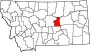 | |
| Unincorporated communities | ||
This Petroleum County, Montana state location article is a stub. You can help Wikipedia by expanding it. |