
Alabama State Route 83
This article needs additional citations for verification. (February 2024) |
State Route 83 | ||||
|---|---|---|---|---|
 | ||||
| Route information | ||||
| Maintained by ALDOT | ||||
| Length | 24.274 mi[1] (39.065 km) | |||
| Major junctions | ||||
| South end | ||||
| North end | ||||
| Location | ||||
| Country | United States | |||
| State | Alabama | |||
| Counties | Conecuh, Monroe | |||
| Highway system | ||||
| ||||
| ||||

State Route 83 (SR 83) is a 24-mile-long (39 km) state highway in Conecuh and Monroe counties in the southern part of the U.S. state of Alabama. The southern terminus of the highway is at an intersection with US 31/US 84 in Evergreen. The northern terminus of the highway is at an intersection with SR 47 at the unincorporated community of Midway in Monroe County.
Route description[edit]
SR 83 heads northward from Evergreen along a two-lane road. Just north of the city, the highway has an interchange with Interstate 65 (I-65), offering motorists in the area direct access to Mobile to the southwest and Montgomery and Birmingham to the north. North of the interchange with I-65, SR 83 travels through rural areas, serving only the unincorporated communities of Lyeffion and Midway before reaching its northern terminus in eastern Monroe County.[citation needed]
Major intersections[edit]
| County | Location | mi[1] | km | Destinations | Notes |
|---|---|---|---|---|---|
| Conecuh | Evergreen | 0.000 | 0.000 | Southern terminus | |
| 2.093 | 3.368 | I-65 exit 96 | |||
| Monroe | Midway | 24.274 | 39.065 | Northern terminus | |
| 1.000 mi = 1.609 km; 1.000 km = 0.621 mi | |||||
Gallery[edit]
-
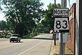 Northbound reassurance marker in Evergreen
 -
 Signage at southern terminus in Evergreen
.jpg)
.jpg)
See also[edit]
References[edit]
- ^ a b Alabama Department of Transportation. "Milepost Maps". Archived from the original on July 27, 2011. Retrieved June 25, 2011.